
Images


August 6, 2022 - Tropical Storm Gorgette
 Tweet
Tweet
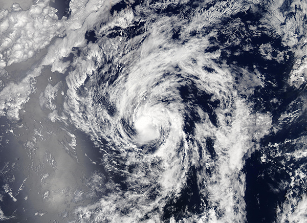
On July 27, 2022, the eighth named storm of the Eastern Pacific Hurricane Season formed about 555 miles (895 km) southwest of the southern tip of Baja California. The system was named Georgette that evening as maximum sustained winds reached 45 mph (75 km/h).
Tropical Storm Georgette stayed away from land, moving generally westward over open waters. Maximum sustained winds peaked at 50 mph (80.5 km/h) by early on July 28 and retained that windspeed through July 31. After that time, Georgette began to battle increasing vertical windshear, causing the storm to weaken and turn towards the north. Late on July 31, maximum sustained winds dropped to 35 mph (56.3 km/h) and stayed at that strength through the morning of August 3.
The National Hurricane Center (NHC) issued the last advisory on Georgette at 2100 UTC (5:00 p.m. EDT) on August 3. At that time, Georgette had degenerated into a remnant low, with maximum sustained winds of only 30 mph (45 km/h). It was located about 1,310 miles (2,110 km) west-southwest of the southern tip of Baja California and was moving nearly due north at 8 mph (13 km/h).
On August 3, the Moderate Resolution Imaging Spectroradiometer (MODIS) on board NASA’s Aqua satellite acquired a true-color image of Georgette close to the time the storm weakened to a remnant low and took a turn westward. At the time the image was acquired, Georgette retained weak convection around a cloud-filled center but had become elongated and asymmetric.
Image Facts
Satellite:
Aqua
Date Acquired: 8/3/2022
Resolutions:
1km (1.6 MB), 500m (4.6 MB), 250m (3.3 MB)
Bands Used: 1,4,3
Image Credit:
MODIS Land Rapid Response Team, NASA GSFC
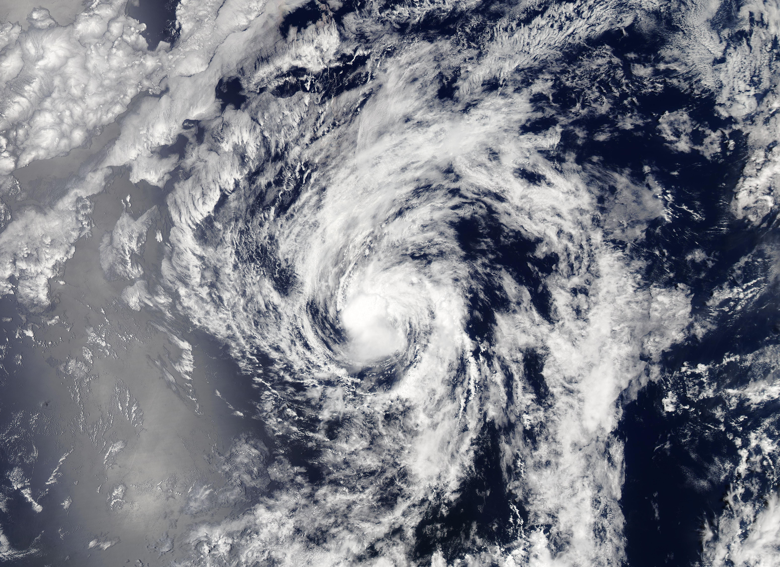
On July 27, 2022, the eighth named storm of the Eastern Pacific Hurricane Season formed about 555 miles (895 km) southwest of the southern tip of Baja California. The system was named Georgette that evening as maximum sustained winds reached 45 mph (75 km/h).
Tropical Storm Georgette stayed away from land, moving generally westward over open waters. Maximum sustained winds peaked at 50 mph (80.5 km/h) by early on July 28 and retained that windspeed through July 31. After that time, Georgette began to battle increasing vertical windshear, causing the storm to weaken and turn towards the north. Late on July 31, maximum sustained winds dropped to 35 mph (56.3 km/h) and stayed at that strength through the morning of August 3.
The National Hurricane Center (NHC) issued the last advisory on Georgette at 2100 UTC (5:00 p.m. EDT) on August 3. At that time, Georgette had degenerated into a remnant low, with maximum sustained winds of only 30 mph (45 km/h). It was located about 1,310 miles (2,110 km) west-southwest of the southern tip of Baja California and was moving nearly due north at 8 mph (13 km/h).
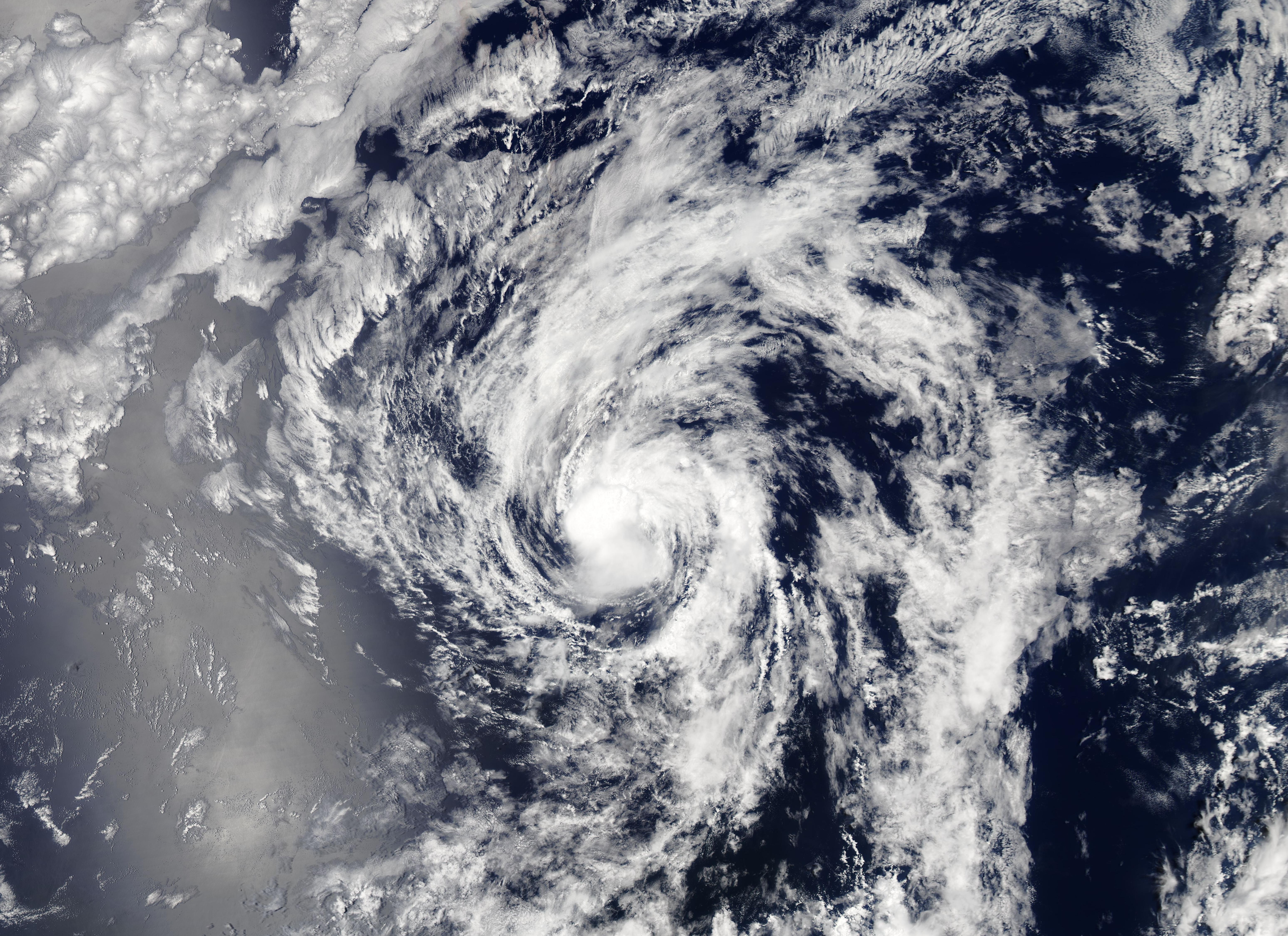
On August 3, the Moderate Resolution Imaging Spectroradiometer (MODIS) on board NASA’s Aqua satellite acquired a true-color image of Georgette close to the time the storm weakened to a remnant low and took a turn westward. At the time the image was acquired, Georgette retained weak convection around a cloud-filled center but had become elongated and asymmetric.
Image Facts
Satellite:
Aqua
Date Acquired: 8/3/2022
Resolutions:
1km (1.6 MB), 500m (4.6 MB), 250m (3.3 MB)
Bands Used: 1,4,3
Image Credit:
MODIS Land Rapid Response Team, NASA GSFC
