
Images


August 15, 2022 - Lesser Sunda Islands
 Tweet
Tweet
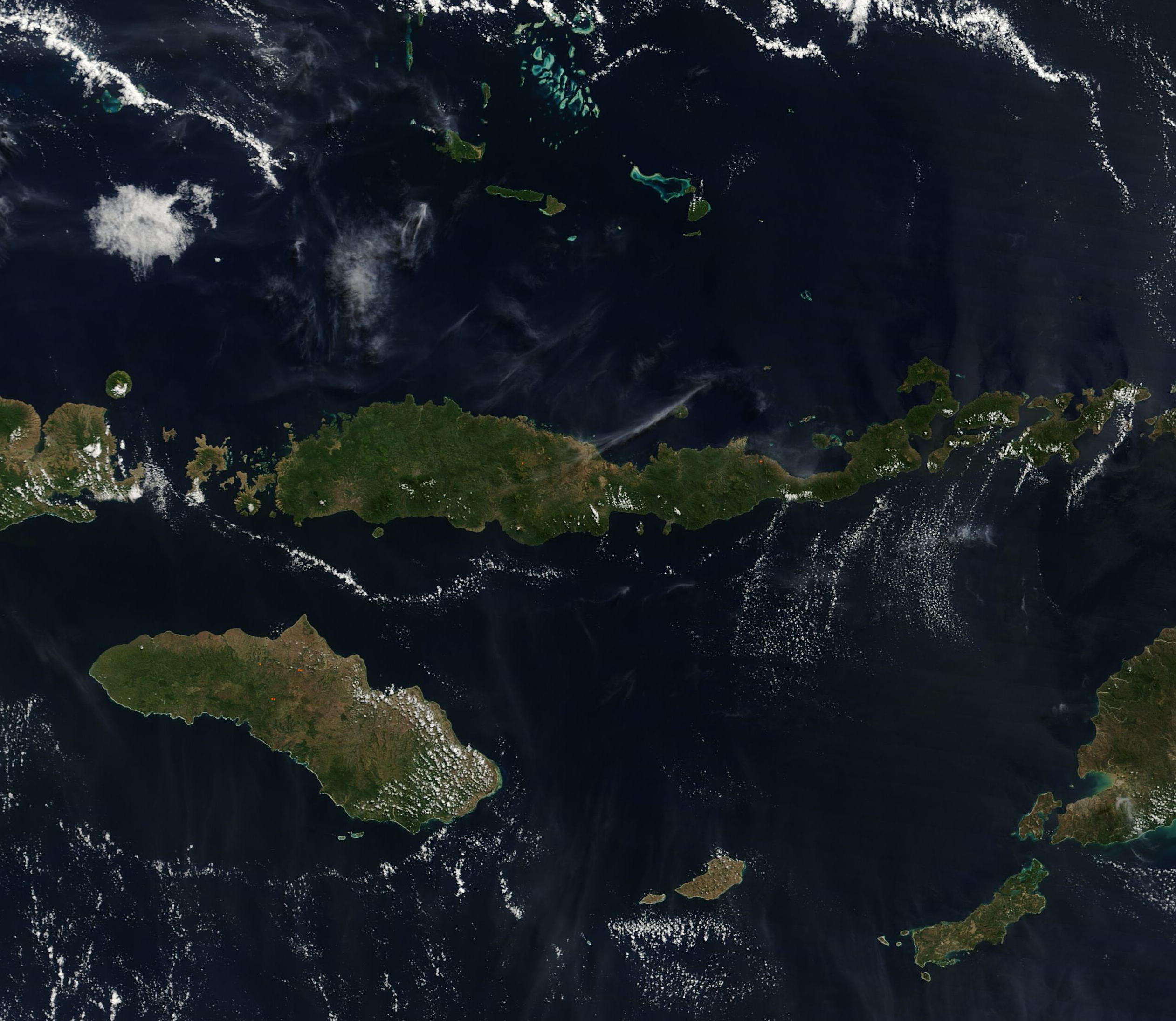
Fair-weather clouds speckle the skies near the Lesser Sunda Islands in this true-color image acquired by the Moderate Resolution Imaging Spectroradiometer (MODIS) on board NASA’s Terra satellite on August 4, 2022.
A beautiful string of variously-sized islands, the Lesser Sunda Islands are located in Marine Southeast Asia and northwest of Australia. The islands stretch about 746 miles (1,200 km) from west to east between Java Island in the west and island of Timor in the east. The archipelago is volcanic in origin, with at least eleven volcanoes still considered active. The location and geography of the Lesser Sunda Islands gives them a warm, humid climate—and also places them at risk for earthquake, flooding, and tropical cyclones.
This image captures only a few of the islands of the Lesser Sundas. These can be divided into two arcs, the Inner Banda Arc in the north and the Outer Banda Arc, which dips southward.
The longest island, which stretches across most of the image, is called Flores Island. It is the 10th largest island in Indonesia. West of Flores are the Komodo Islands, home to the large and fierce Komodo Dragon. The eastern tip of the island of Sumbawa can be seen along the left edge of the image. To the northeast of Sumbawa sits a small, round island partially obscured by cloud. This is the home of Sangeang Api volcano which discharged ash plumes as recently as February 2022. The major islands of the Outer Band Arc include Sumba, which sits south of Komodo and Flores, Savu, Roti, and Timor. Only the far western tip of Timor can be seen in this image.
Image Facts
Satellite:
Terra
Date Acquired: 8/4/2022
Resolutions:
500m (846.3 KB), 250m (2.3 MB)
Bands Used: 1,4,3
Image Credit:
MODIS Land Rapid Response Team, NASA GSFC
