
Images


December 2, 2022 - Mauna Loa Erupts
 Tweet
Tweet
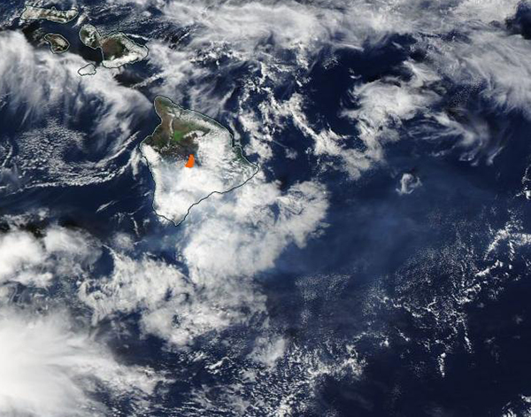
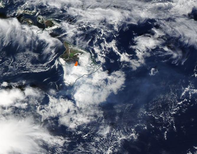
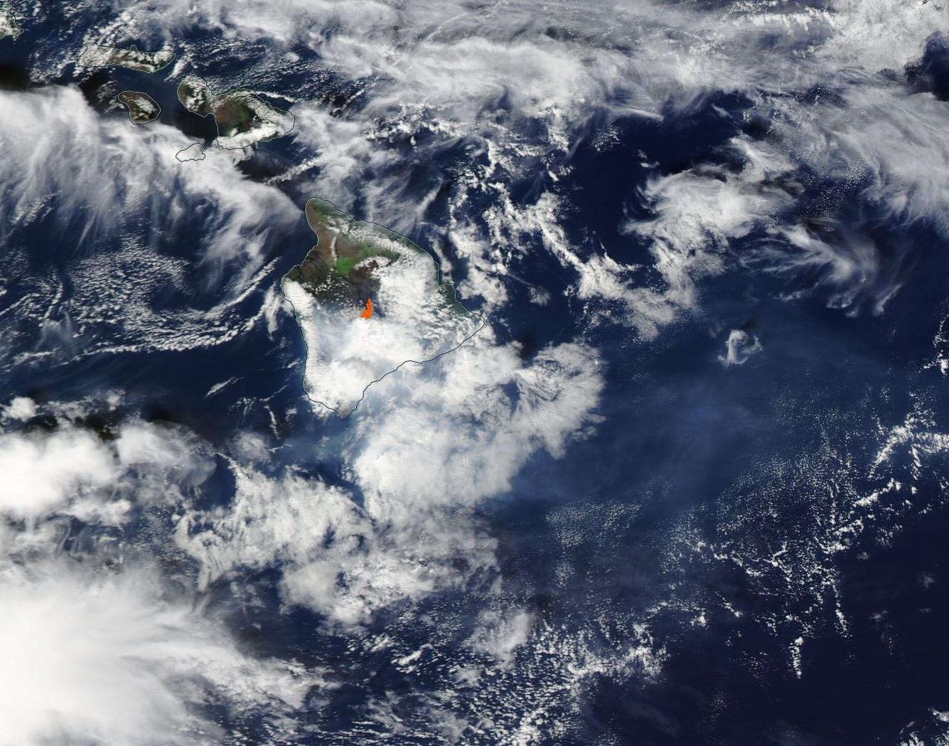
The world’s largest active volcano—Hawaii’s Mauna Loa—has been quiet for the past four decades. But in November 2022, the volcano began to stir.
The first signs of unrest emerged in early October 2022, when U.S. Geological Survey data showed a tenfold increase in small earthquakes beneath the volcano’s summit caldera—a result of the underground movement of magma. Swarms of earthquakes continued sporadically through November 27, 2022, when new fissures began to spill lava across the caldera floor at 11:30 p.m. local time. Most of the lava fountains were only a few yards tall, though some of the tallest rose as high as 100–200 feet (30–60 meters). The lava flows in the caldera had quieted by the next day, although other fissures had become active. As of December 1, four days after the eruption began, only two fissures remained active, and these were located on the volcano’s Northeast Rift Zone. Lava flows were traveling to the north-northeast.
On November 30, 2022, the Moderate Resolution Imaging Spectroradiometer (MODIS) on board NASA’s Terra satellite acquired a true-color image of the Island of Hawai’i. A large red “hot spot” marks the heat from the eruption at Mauna Loa, including the long lava flows that have been spilling from the active fissures. Kilauea volcano is also continuing its low-level eruptive phase on the Big Island. It is located to the east of Mauna Loa and is obscured by cloud cover.
Although a distinct plume of volcanic gas and ash is not visible in this image, the blue-tinted haze to the southeast of the island is likely vog (volcanic smog). Vog is a mix of water vapor, carbon dioxide, and sulfur dioxide—the substances that make up 99 percent of gas released in a volcanic eruption. Sulfur dioxide reacts with atmospheric oxygen, sunlight, moisture, and other gases to create fine particles, which scatter sunlight to create a visible haze.
The United States Geological Survey (USGS) maintains a Mauna Loa Eruption Webpage, which is updated daily with activity, data, and hazard information as well as video and photographs of the eruption. According to that site, lava flow from Mauna Loa crossed Mauna Loa Weather Observatory Road on the evening of November 28. As of December 1, no property was considered to be at risk. A gas plume continued to be present from the erupting fissure fountains and lava flows, with the plume primarily being blown to the northwest. To follow the eruption, the USGS Mauna Loa Eruption Webpage can be accessed by clicking here.
Image Facts
Satellite:
Terra
Date Acquired: 11/30/2022
Resolutions:
1km (71.6 KB), 500m (225.9 KB), 250m (647 KB)
Bands Used: 1,4,3
Image Credit:
MODIS Land Rapid Response Team, NASA GSFC
