
Images


December 26, 2022 - Southeastern Australia
 Tweet
Tweet
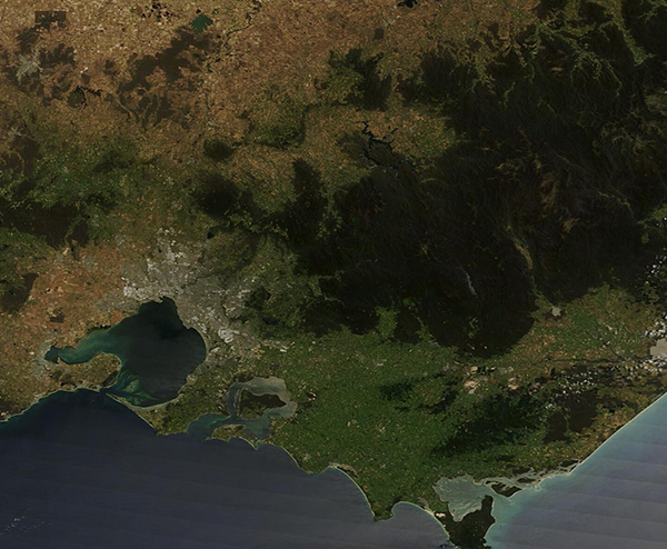
On December 19, 2022, the skies were clear over Southeastern Australia when the Moderate Resolution Imaging Spectroradiometer (MODIS) on board NASA’s Terra satellite acquired a true-color image of the region. The two states visible are Victoria, which sits in the south along the Bass Strait, and New South Wales, in the north. The Murray River forms the border between the two states and, because of recent heavy rains, can easily be seen meandering from west to east.
Along the southern coast, the city of Melbourne appears as a mass of gray pixels wrapping around the huge Port Phillip Bay. Just east of Melbourne the land rises into the Yarra Ranges, a mountainous area of cool temperature forest between the city and the more easterly Victorian Alps. The Yarra Ranges National Park is home to the world’s tallest flowering tree, the Mountain Ash. In the lower elevations of the Yarra Valley, fertile red soil and a cool climate spurs grape cultivation and the production of wine, especially Chardonnay, Pinot Noir, and sparkling wine.
Image Facts
Satellite:
Terra
Date Acquired: 12/19/2022
Resolutions:
1km (128.4 KB), 500m (354.9 KB), 250m (775.2 KB)
Bands Used: 1,4,3
Image Credit:
MODIS Land Rapid Response Team, NASA GSFC
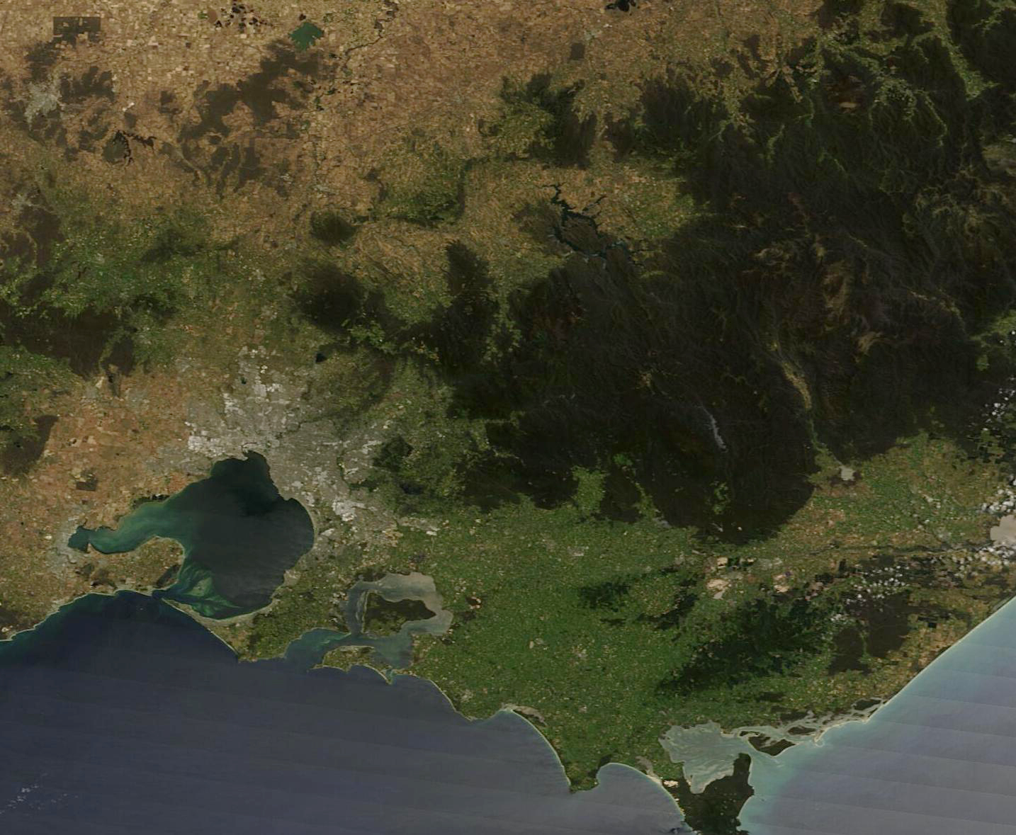
