
Images


January 11, 2023 - Hawaii
 Tweet
Tweet
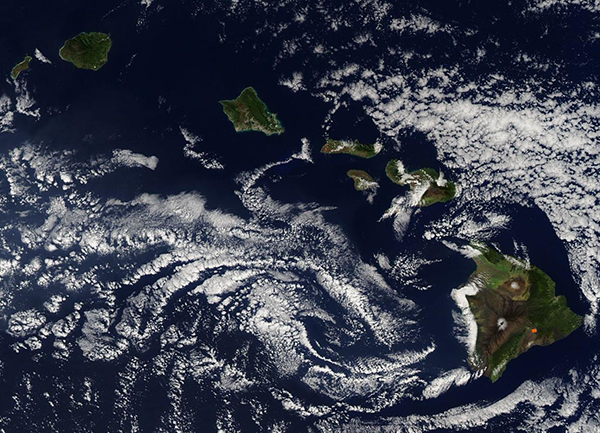
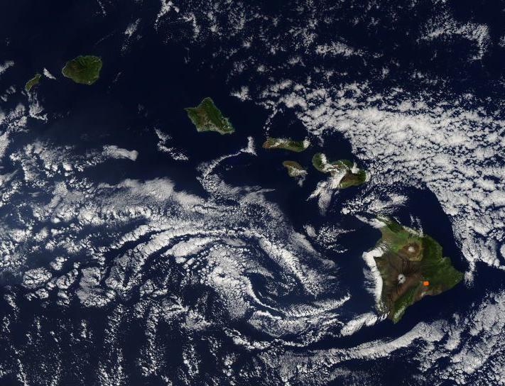
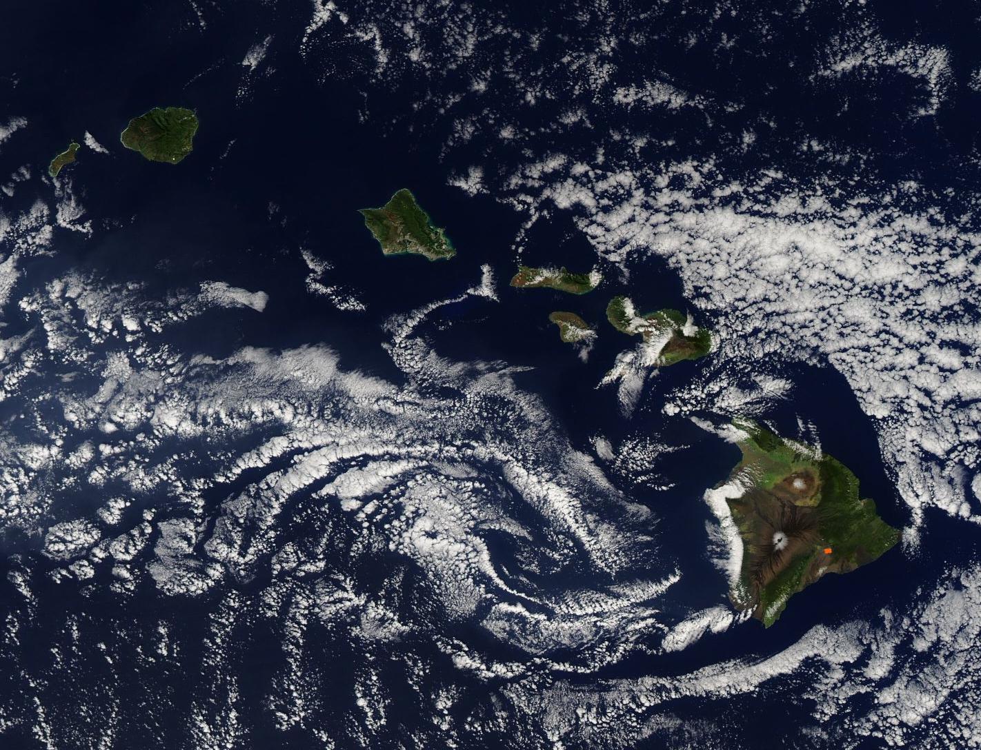
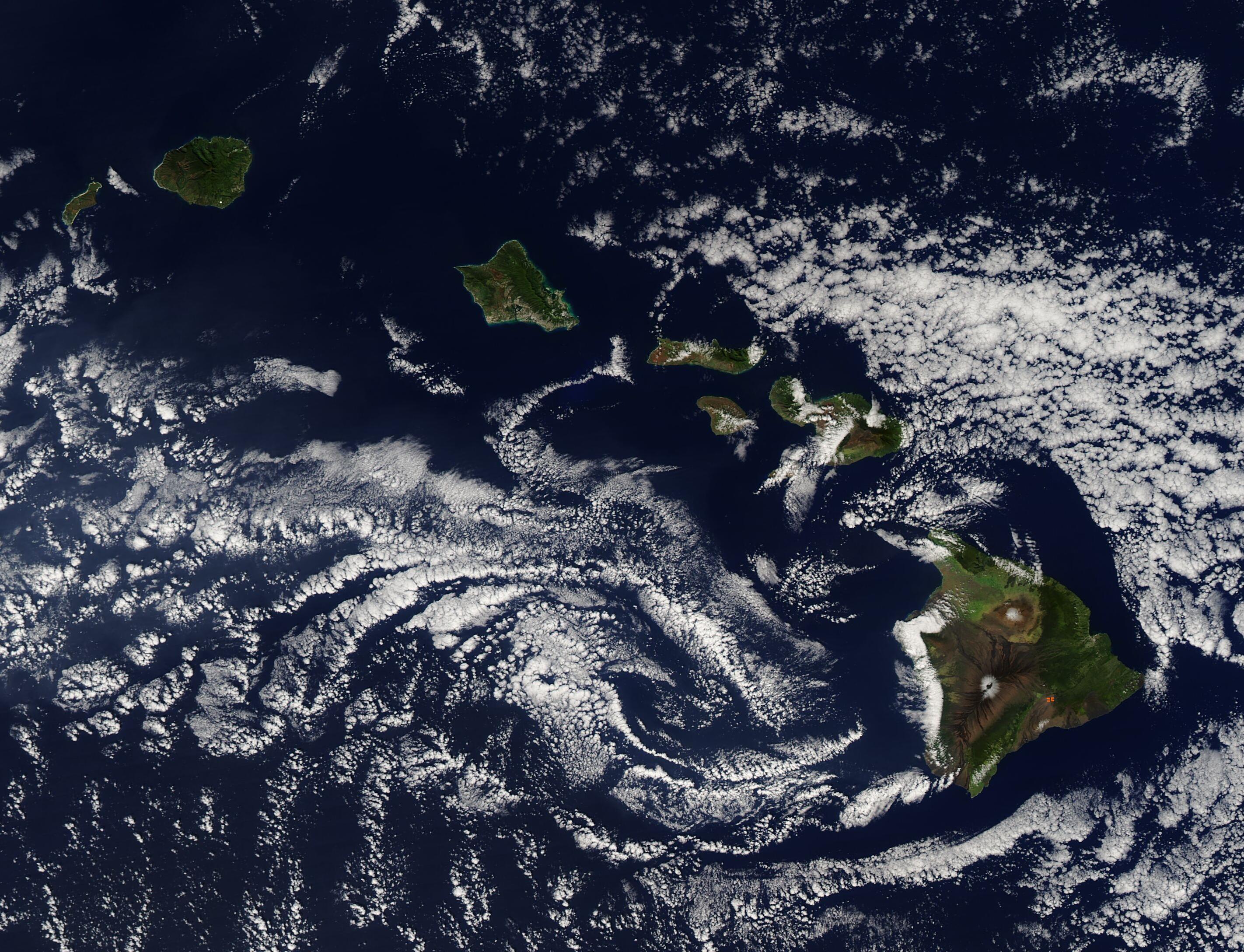
Clouds surrounded the Hawaiian Islands on January 9, 2023, when the Moderate Resolution Imaging Spectroradiometer (MODIS) on board NASA’s Aqua satellite acquired a true-color image of the idyllic scene.
Hawaii was admitted as the 50th state of the United States in 1959, and is the only state made up entirely of islands. Sometimes called “The Crossroads of the Pacific”, this state lies about 2,397 miles (3,857 km) west of San Francisco, California and 5,293 miles (8,516 km) east of Manila, in the Philippines. From east to west, the major islands are Hawaii, Maui, Kahoolawe, Lanai, Molokai, Oahu, Kauai, and Niihau.
Hawaii is the largest island, earning it the nickname “Big Island”. The red “hot spot” visible on the island of Hawaii marks Kilauea volcano, which is in eruption. On January 5, a surge of lava was reported from the volcano’s Halema’uma’u crater. According to the National Park Service, “Visitors and rangers saw awe-inspiring fountains that roared 164 feet (50 meters) into the air. Lava flows inundated the crater floor within hours and filled a 277-acre (112 hectares) area; roughly the size of 240 American football fields.”
Image Facts
Satellite:
Aqua
Date Acquired: 1/9/2023
Resolutions:
1km (102.3 KB), 500m (350.3 KB), 250m (1 MB)
Bands Used: 1,4,3
Image Credit:
MODIS Land Rapid Response Team, NASA GSFC
