
Images


January 20, 2023 - Tropical Cyclone Irene
 Tweet
Tweet
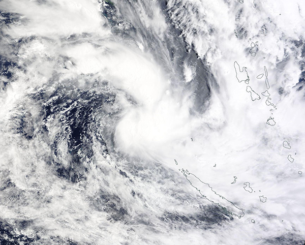
On January 18, 2023, the Moderate Resolution Imaging Spectroradiometer (MODIS) acquired a true-color image of newly-formed Tropical Cyclone Irene as it spun up over the South Pacific basin.
This image shows a strengthening storm sporting a cloud-filled center and asymmetric circulation. The center sits northwest of the island of Grand Terre, New Caledonia, while the storm moves towards the islands of Vanuatu. Near the time this image was captured, Irene’s maximum wind speeds were reported near 64 mph (102 km/h) with gusts to 75 mph (120 km/h) and the storm was tracking east-southeast at 28.5 mph (46 km/h).
The storm moved across Vanuatu on January 18, coming close to the island of Éfaté. Although it did not make landfall, local media reports flooding, downed trees, and power outages on that island, particularly in and around Port Vila, the capital and largest city of Vanuatu. Irene appears to have made landfall over the island of Tanna, Vanuatu, later than day carrying maximum sustained winds of about 50 mph (80.5 km/h). No damage reports have been published from the tiny island, which measures only 12 miles (19 km) wide and 25 miles (40 km) long.
On January 19, Tropical Cyclone Irene had weakened and began to transition to a sub-tropical system, leading the Joint Typhoon Warning Center to issue its last advisory on the storm. High swells, gusting winds, and rain will continue to affect Vanuatu and Fiji as Irene continues weaken as it passes by the islands.
Image Facts
Satellite:
Terra
Date Acquired: 1/18/2023
Resolutions:
1km (290.5 KB), 500m (909.3 KB), 250m (2.6 MB)
Bands Used: 1,4,3
Image Credit:
MODIS Land Rapid Response Team, NASA GSFC
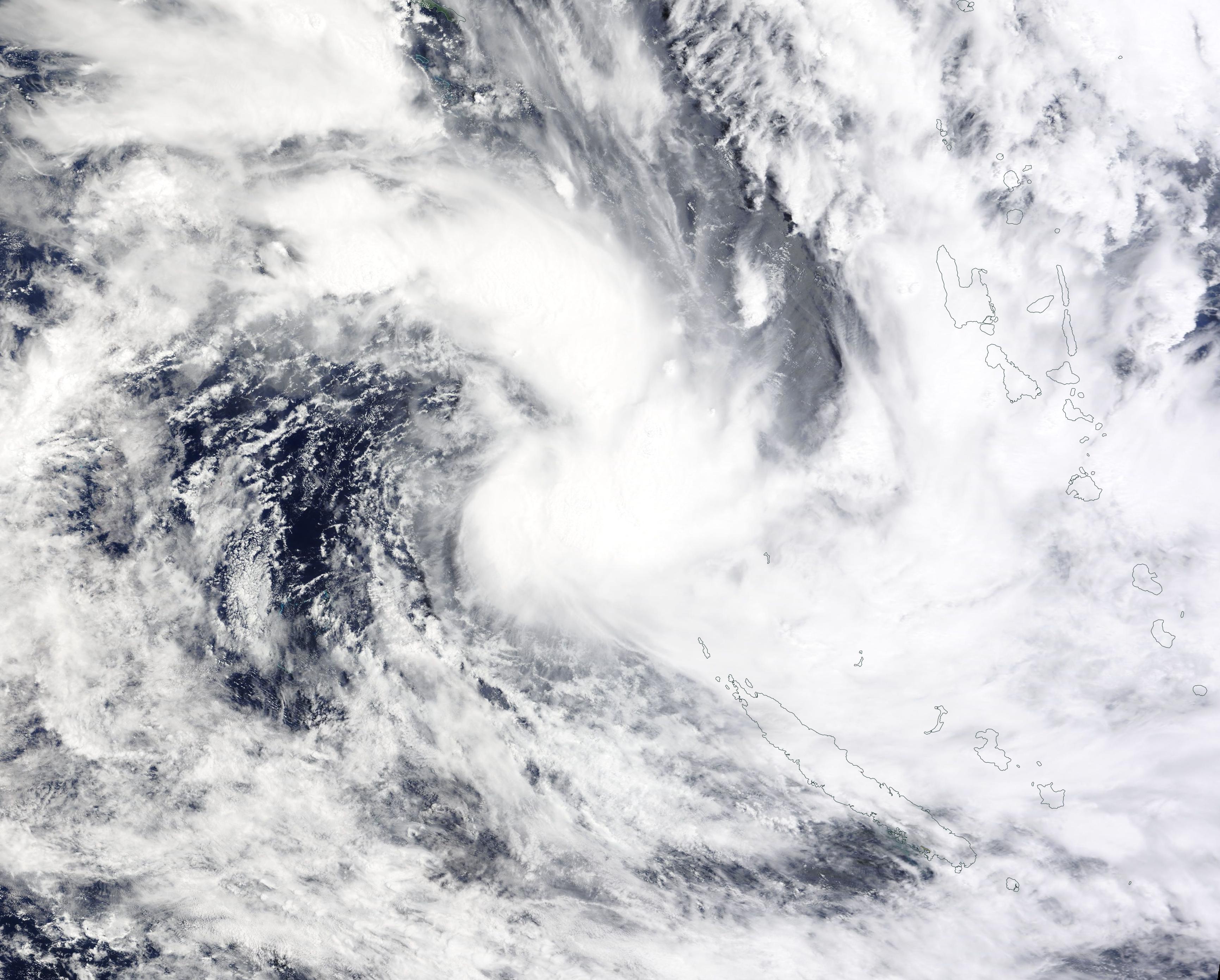
