
Images


February 1, 2023 - The Meta River
 Tweet
Tweet
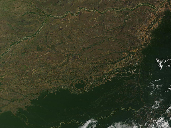
On January 31, 2023, the Moderate Resolution Imaging Spectroradiometer (MODIS) on board NASA’s Terra satellite acquired a true-color image of northern South America.
The tan-tinted river meandering from west to east across the top of the image is the Meta River. With its origins in the high Andes of Colombia, the Meta winds east-northeastward across the plains of northern South America for about 650 miles (1,046 km). It forms the boundary between Colombia (south) and Venezuela (north) for a short distance before the Meta empties into the Orinoco River between Puerto Carreño, Colombia and Puerto Páez, Venezuela.
The meeting of the Meta and Orinoco Rivers can be seen in the upper right corner of the image, where the tan waters of the Meta seem to abruptly end, and the much smaller Orinoco can be seen flowing from the southwest to the north. In this location, the Meta flows through tropical grasslands of Colombia, which appear light green and tan. The Orinoco River skirts the heavily forested Paraguaza Range of the western Guiana Highlands in Venezuela.
Image Facts
Satellite:
Terra
Date Acquired: 1/31/2023
Resolutions:
1km (162.2 KB), 500m (481.1 KB), 250m (1.4 MB)
Bands Used: 1,4,3
Image Credit:
MODIS Land Rapid Response Team, NASA GSFC
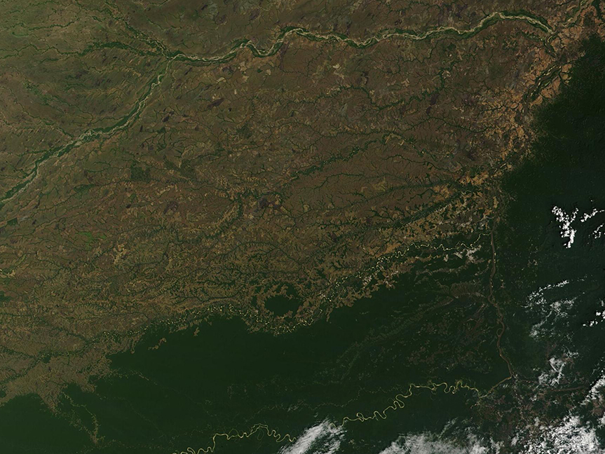
