
Images


February 18, 2023 - Powerful Tropical Cyclone Freddy crossing the Indian Ocean
 Tweet
Tweet
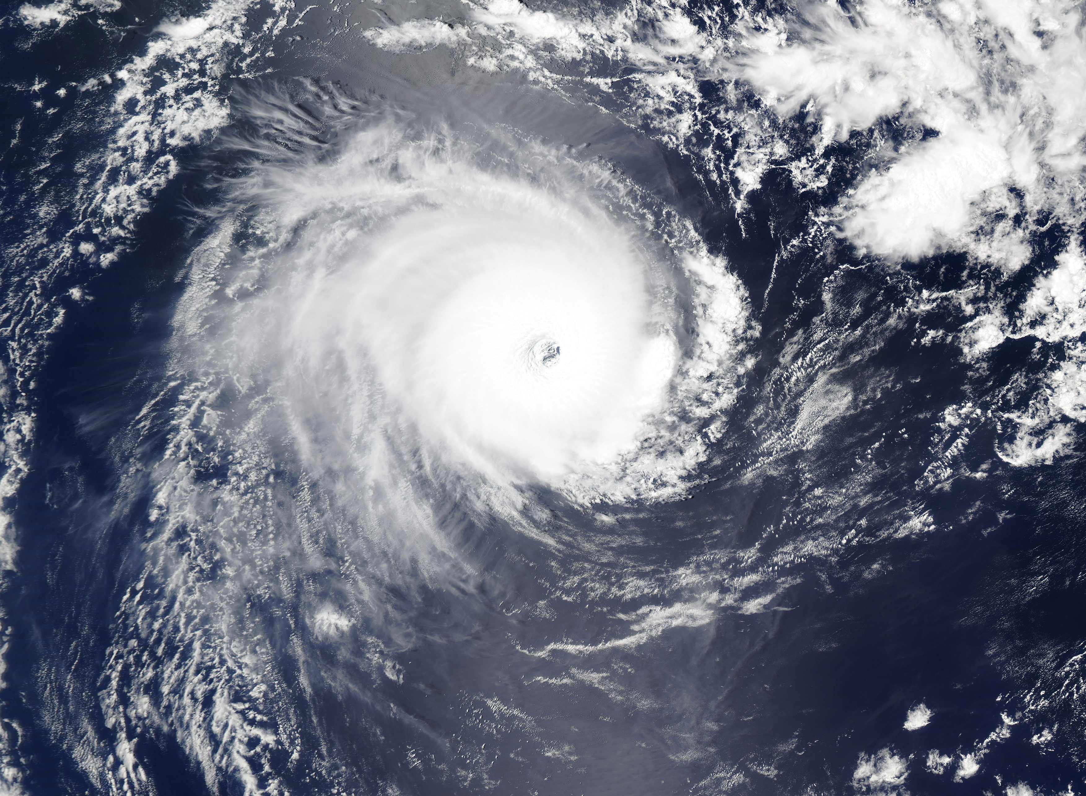
NASA’s Terra satellite acquired a true-color image of Intense Tropical Cyclone Freddy tracking westward across the Indian Ocean on February 17, 2023. It was located roughly half-way between Indonesia, where it formed on February 6, and Madagascar—where it is likely to make landfall by February 21.
Near the time the image was captured, the compact storm with a large, distinct eye was carrying maximum sustained winds of about 140 mph (225 km/h), placing it as a Category 4 storm on the Saffir-Simpson Hurricane Wind Scale. While still quite strong, Freddy had diminished from its peak strength. On February 15, maximum sustained winds had reached 165 mph (266 mph), or the equivalent of a Category 5 hurricane.
Not only is Tropical Cyclone Freddy a remarkably strong storm, it is on track to become one of the longest-tracking in the region. Weather Underground reports that of all cyclones in the southern Indian Ocean that became Category 1 intensity, only one previous storm has tracked from near Indonesia all the way to Madagascar. That was Cyclone Eline/Leone in February 2000, and it was a destructive storm that also struck Africa and travelled well inland.
Tropical Cyclone Freddy appears to be on a similar track. It is forecast to make landfall on Madagascar between February 20-21 carrying maximum sustained winds of about 90 mph (145 km/h), or the equivalent of a strong Category 1 hurricane. After moving over the island, it may strengthen over the Mozambique Channel before making a second landfall in Mozambique.
Image Facts
Satellite:
Aqua
Date Acquired: 2/17/2023
Resolutions:
1km (1.8 MB), 500m (4.8 MB), 250m (3.6 MB)
Bands Used: 1,4,3
Image Credit:
MODIS Land Rapid Response Team, NASA GSFC
