
Images


February 27, 2023 - Iceberg B22A adrift in Antarctica
 Tweet
Tweet
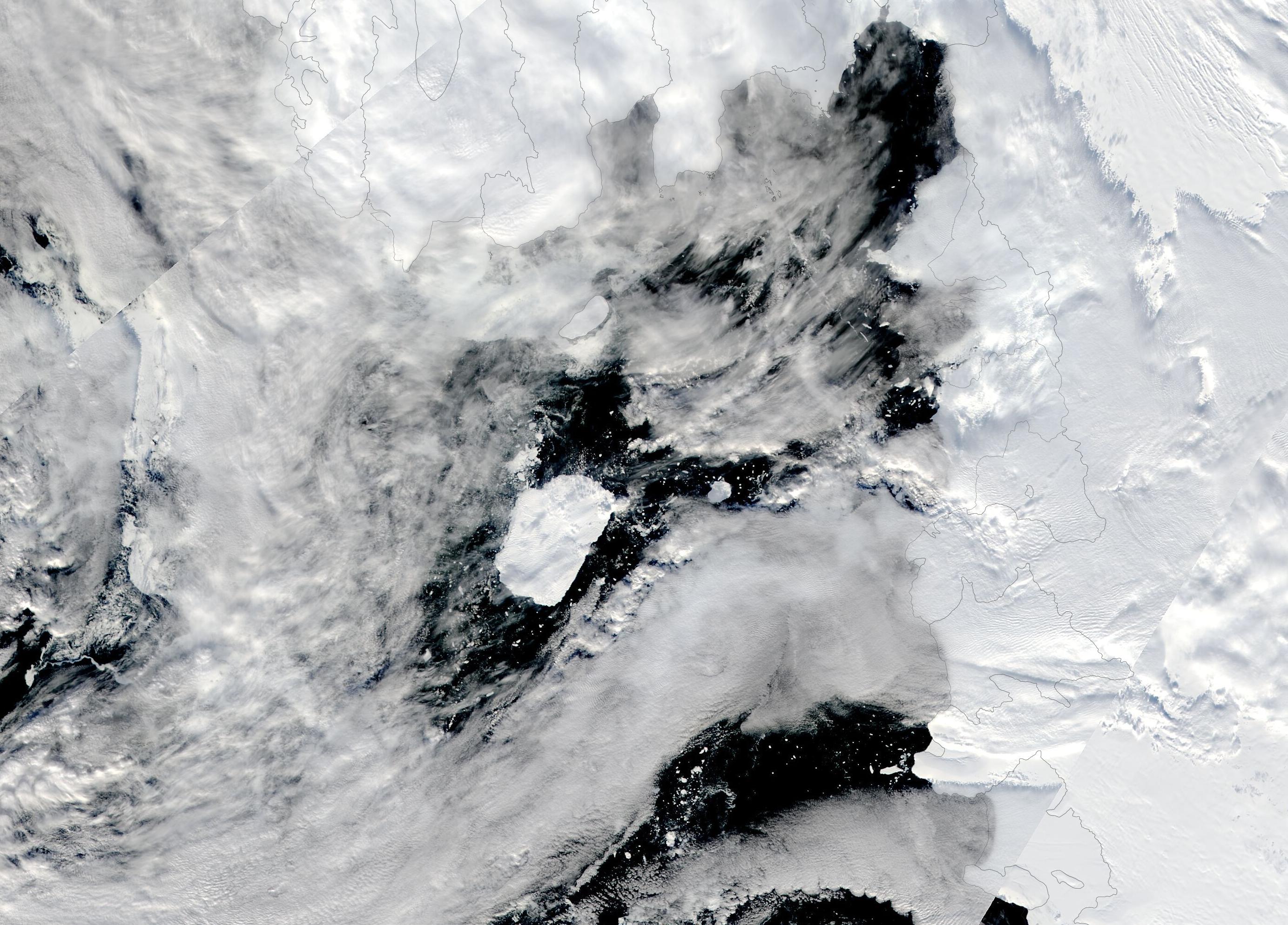
On February 18, 2023, clouds parted over the Amundsen Sea, allowing the Moderate Resolution Imaging Spectroradiometer (MODIS) on board NASA’s Aqua satellite to capture a true-color image of Iceberg B-22A adrift in Antarctica.
In March 2002, a large iceberg broke away from the floating ice tongue of the Thwaites glacier. It was given the name Iceberg B-22 and, at the time that it detached, measured 85 kilometers (53 miles) long and 64 kilometers (40 miles) wide—about twice the size of Rhode Island. A few sizable pieces broke off from the berg, and the main piece was renamed B-22A. More than two decades later, on February 24, the U.S. National Ice Center reports that B-22A hasn’t changed all that much, now measuring 69.4 km (43.1 miles) by 44.4 km (27.6 miles).
While the iceberg is currently adrift, it still hasn’t moved far from its birthplace. Shortly after breaking free of the Thwaites ice tongue, B-22A became stuck, or “grounded” in a relatively shallow part of the Amundsen Sea. On January 20, 2023, the European Union’s Earth Observation Programme, Copernicus, estimated that B-22A had drifted a total of 112 kilometers (69.6 miles), with 21 kilometers (13 miles) occurring between December 2022 and January 2023.
Today’s image shows that Iceberg B-22A, floating in nearly ice-free Antarctic water, has continued to drift to the northwest. The gap between the iceberg and the glacial tongue appears to be widening, but a single image can only give an impression of a single moment in time. The NASA Worldview App follows the track of significant icebergs, showing long-term motion. Using this tracker, which can be found here, it becomes clear that the motion of Iceberg B-22A has, in fact, accelerated over the past few months.
Image Facts
Satellite:
Aqua
Date Acquired: 2/19/2023
Resolutions:
1km (311.1 KB), 500m (876.8 KB), 250m (684.5 KB)
Bands Used: 1,4,3
Image Credit:
MODIS Land Rapid Response Team, NASA GSFC
