Images
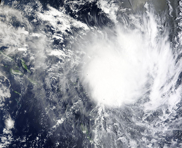
February 28, 2023 - Tropical Cyclone Judy approaching Vanuatu
Tweet
On February 27, 2023, the Moderate Resolution Imaging Spectroradiometer (MODIS) on board NASA’s Terra satellite captured a true-color image of newly-formed Tropical Cyclone Judy spinning up over the South Pacific Ocean. It was tracking southwest through the Solomons Islands and taking aim at Vanuatu.
According to the Joint Typhoon Warning Center (JTWC), by 4:00 p.m. EST (2100 UTC) on February 27, Judy was carrying maximum sustained winds of about 57.5 mph (92.5 km/h) and was “primed and ready to rapidly intensify”. Peak intensity is expected to be reached on February 28 or March 1, with maximum sustained winds reaching 103.6 mph (167 km/h), which would place it as a Category 2 storm on the Saffir-Simpson Hurricane Wind Scale.
Tropical Cyclone Judy will pass through the island nation of Vanuatu over the next two days and is expected to make landfall over the island of Port Vila on March 1 at or near peak strength. Gale-force winds and high seas are expected to impact many other islands as well. Vanuatu has posted Red Alerts for the provinces of Penama, Torba, and Sanma due to expectations of high winds and flooding.
Image Facts
Satellite:
Terra
Date Acquired: 2/27/2023
Resolutions:
1km (473.7 KB), 500m (1.5 MB), 250m (4.3 MB)
Bands Used: 1,4,3
Image Credit:
MODIS Land Rapid Response Team, NASA GSFC


