
Images


March 19, 2023 - Sediment in the Albemarle-Pamlico Estuary and Atlantic Ocean
 Tweet
Tweet
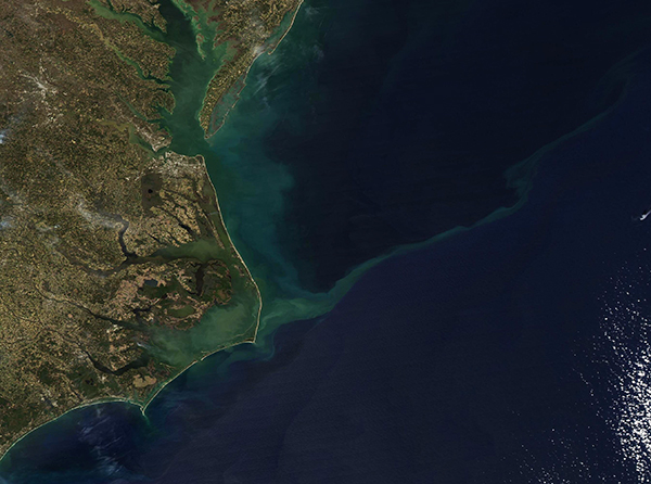
On March 16, 2023, the Moderate Resolution Imaging Spectroradiometer (MODIS) on NASA’s Aqua satellite acquired a true-color image highlighting the sediment-rich Albemarle-Pamlico Sounds. Sediment also can be seen in the Chesapeake Bay (north) and a long tendril of sediment curls into the Atlantic Ocean.
The bright white streaks along the Atlantic Ocean are the beaches along the barrier islands known as the Outer Banks. The white sands and tourist towns, such as Hatteras and Duck, North Carolina are a favorite summer getaway for tourists, while protected dunes and wildlands provide habitat for a wide array of wildlife. Kill Devil Hills, near Kitty Hawk, North Carolina, was the site of the first flight by Orville Wright on December 17, 1903.
The barrier islands separate the Atlantic Ocean (east) and a sprawling and complicated coastal system in the west. Butting up against the western side of the barrier islands are the Albemarle Sound (north) and the larger Pamlico Sound (south). Behind these sprawling sounds are six large freshwater river basins, rich agricultural regions, forests, and dense cities. The entire drainage area of the Albemarle-Pamlico Sounds (also known as the Albemarle-Pamlico Estuary) includes about 28,000 square miles of northeastern North Carolina and southeastern Virginia, and is home to roughly 4 million people.
The estuary itself covers about 2 million acres, making it the second-largest estuary in the United States. Under the water, most of the estuary bottom is covered in a thick layer of mud, while some areas are mostly sandy. This, along with sediment carried into the sounds by the large rivers, creates the perfect scenario for abundant suspended sediment within the estuary. Most of the time, the barrier islands retain sediment within the Albemarle-Pamlico Sounds, but sometimes, especially after strong and windy storms, such as occurred on March 12-15, sediment may stretch far into the Atlantic Ocean.
Image Facts
Satellite:
Aqua
Date Acquired: 3/16/2023
Resolutions:
1km (254.6 KB), 500m (661.8 KB), 250m (1.2 MB)
Bands Used: 1,4,3
Image Credit:
MODIS Land Rapid Response Team, NASA GSFC
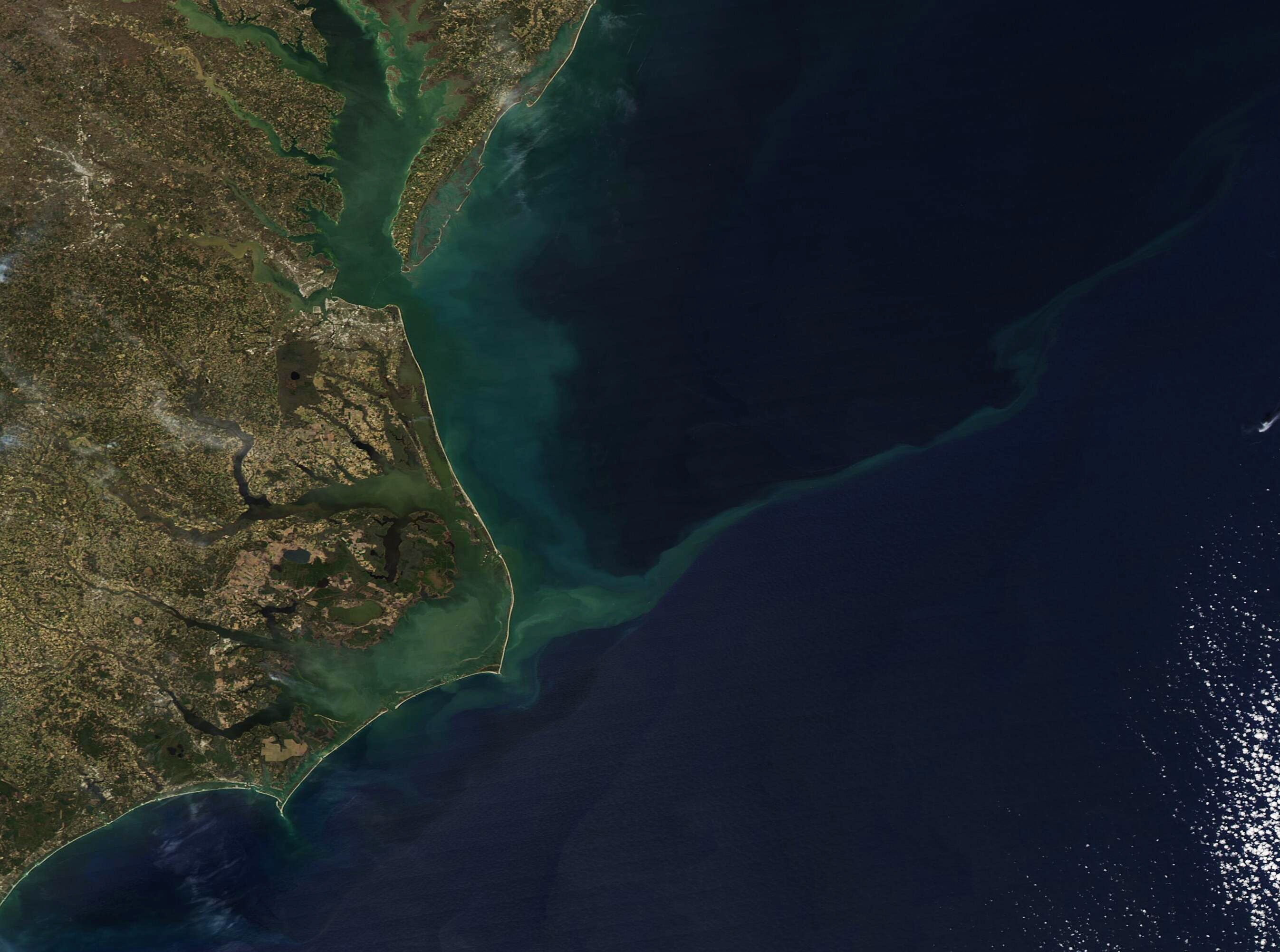
