
Images


April 1, 2023 - Tropical Cyclone Herman
 Tweet
Tweet
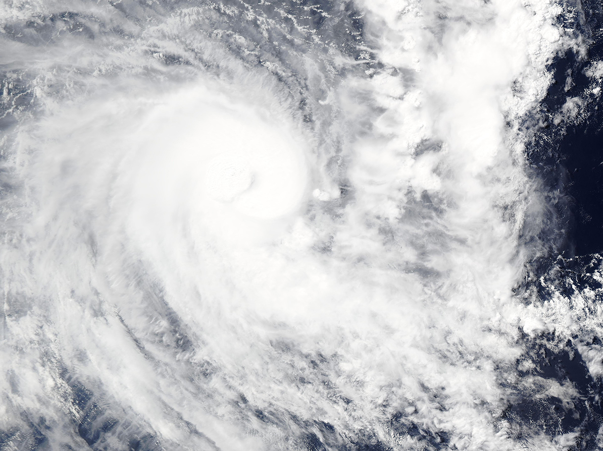
On March 30, 2023, the Moderate Resolution Imaging Spectroradiometer (MODIS) on the Aqua satellite acquired a true-color image of Tropical Cyclone Herman intensifying as it tracked towards Australia.
The storm formed near Cocos (Kelling) islands, a remote territory of Australia in the Indian Ocean on March 28. By the end of the day on March 30, maximum sustained winds had increased to 115 mph (185 km/h), placing it as a Category 3 storm on the Saffir Simpson Hurricane Wind Scale. Near the time the image was acquired, the strong storm was located about 1,367 km (850 miles) northwest of Learmonth, Australia and heading southeast, directly toward that location.
On March 31, Tropical Cyclone Herman reached peak strength, with maximum sustained winds of 125 mph (201 km/h). Fortunately, the track forecast by the Joint Typhoon Warning Center (JTWC) has Herman slowing forward motion as it weakens and turns away from Australia. By April 2, the storm is expected to be a remnant low traveling northwest over the open Indian Ocean.
Image Facts
Satellite:
Aqua
Date Acquired: 3/30/2023
Resolutions:
1km (667.6 KB), 500m (1.7 MB), 250m (1.1 MB)
Bands Used: 1,4,3
Image Credit:
MODIS Land Rapid Response Team, NASA GSFC
