
Images


May 6, 2023 - Frozen Lakes in Manitoba
 Tweet
Tweet
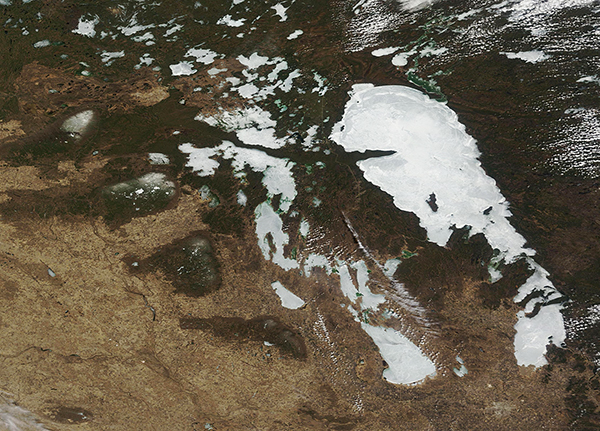
The province of Manitoba, Canada has been called “the land of 100,000 lakes” and on May 4, 2023, most of the many lakes and ponds remained covered in ice.
On that same day, the Moderate Resolution Imaging Spectroradiometer (MODIS) on board NASA’s Terra satellite acquired a true-color image of Lake Winnipeg, said to be the 12th largest freshwater lake on Earth, and several surrounding lakes. To the west of northern Lake Winnipeg, sits Lake Winnipegosis and Lake Manitoba stretches south of Winnipegosis. Together, Lakes Winnipeg, Winnipegosis, and Manitoba are often referred to as Manitoba’s Great Lakes. The lakes are surrounded by wetlands and forest (dark green) and prairie or grasslands (light tan) and are covered with bright white ice.
The origins of the lakes and surrounding wetlands can be traced to the last ice age. The wetlands were created in the low-lying topography ground down by the advancing and retreating ice sheets. The three Manitoba Great Lakes, however, are actual remnants of glacial Lake Agassiz. This was an ice-dammed lake that formed south of the Laurentide Ice Sheet about 14,500 years ago. At its largest, Lake Agassiz was 1,125 kilometers (700 miles) long and 400 kilometers (250 miles) wide. As the ice dams melted and receded at the end of the ice age, about 8,000 years ago, outlets to the sea opened and the lake drained, leaving behind the deeper lakes.
Image Facts
Satellite:
Terra
Date Acquired: 5/4/2023
Resolutions:
1km (580.2 KB), 500m (1.5 MB), 250m (3 MB)
Bands Used: 1,4,3
Image Credit:
MODIS Land Rapid Response Team, NASA GSFC
