
Images


October 3, 2023 - Tropical Storm Philippe
 Tweet
Tweet
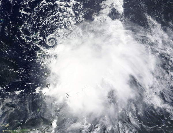
On the morning of October 2, 2023, the Moderate Resolution Imaging Spectroradiometer (MODIS) on NASA’s Terra satellite acquired a true-color image of Tropical Storm Philippe spinning off the northern Leeward Islands. The image showed a struggling tropical storm, with its low-level center fully exposed and convection and heavy rainfall displaced to the southeast due to high northwesterly vertical wind shear.
At 11:00 a.m. EDT (1500 UTC)—near the time the image was acquired—the National Hurricane Center (NHC) advised that Philippe was carrying maximum sustained winds of 50 mph (85 km/h). It was located about 80 miles (135 km) east-southeast of Barbuda and was traveling north-northwest.
Only a few hours later, at 6:00 p.m. EDT (2200 UTC), Tropical Storm Philippe was at the same strength when it made landfall on the island of Barbuda. A tropical storm warning is in effect for Barbuda and Antigua, where heavy rain could produce areas of flash flooding.
According to the NHC, Philippe is moving towards the west-northwest, and it is expected to travel northwestward through October 3 as it passes through the northern Leeward Islands. The strongest winds and heaviest rains will likely occur in the islands to the south of center as wind shear continues to batter the storm. A turn towards the north is expected by October 4, with conditions improving for strengthening after that time.
Image Facts
Satellite:
Terra
Date Acquired: 10/2/2023
Resolutions:
1km (239.7 KB), 500m (776.6 KB), 250m (2.3 MB)
Bands Used: 1,4,3
Image Credit:
MODIS Land Rapid Response Team, NASA GSFC
