
Images


November 22, 2023 - Southeast Asia
 Tweet
Tweet
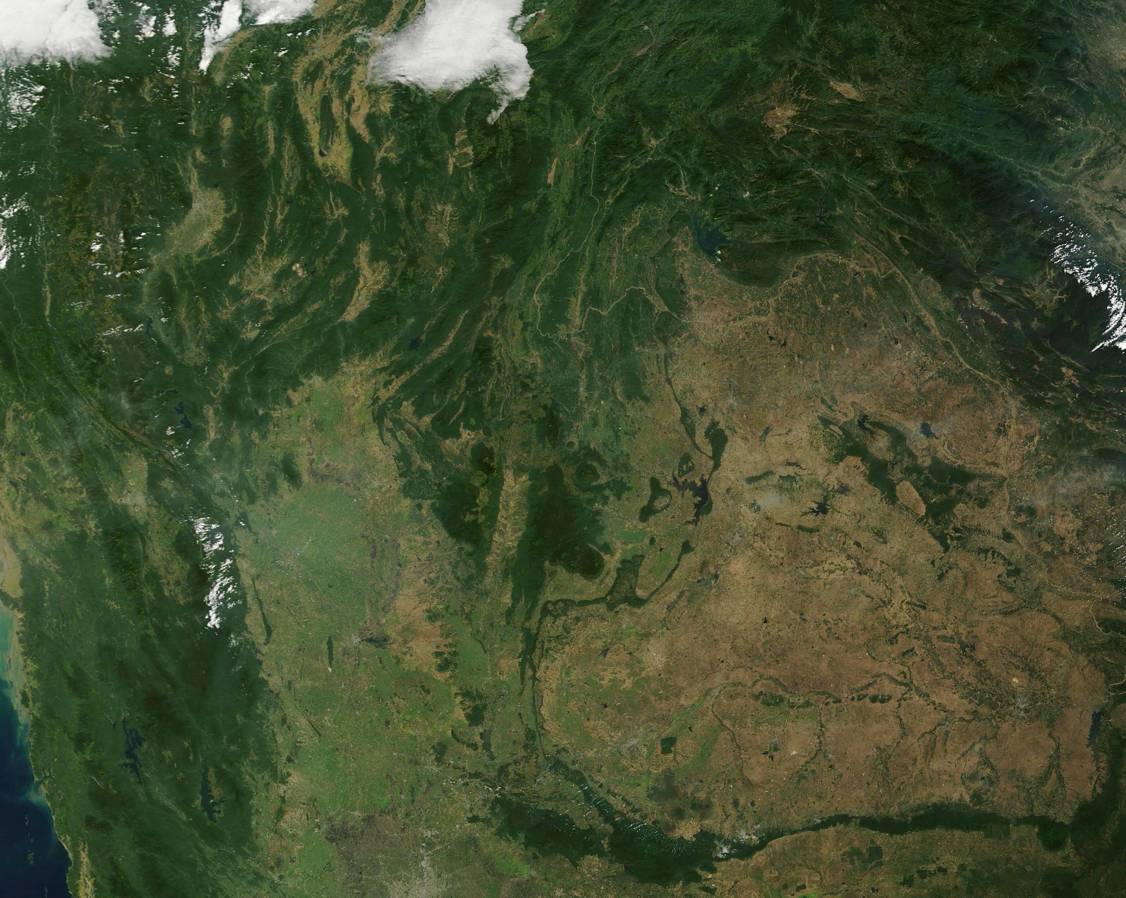
On November 19, 2023, the Moderate Resolution Imaging Spectroradiometer (MODIS) on NASA’s Terra satellite acquired a true-color image centered on northern Thailand. Located in Southeast Asia roughly equidistant from India and China, Thailand is bounded by Myanmar (Burma) in the northwest, Laos in the northeast, Cambodia to the east, and Malaysia in the south. Both Myanmar (Burma) and Laos are also visible in this image.
Spanning about 198,450 square miles (514,000 sq km), Thailand is slightly larger than twice the U.S. state of Wyoming. Several physical features are visible in this image, most prominently the heavily-forested Northern Highlands. The “cool dry season”, which runs from November to February, brings lower temperatures to the highlands and makes it a popular time for tourists to trek the mountains or visit elephant sanctuaries that are found here. Extending southward in the center of the image are the Phetchabun Mountains, a parallel set of mountain chains that rise on either side of the Pa Sak River. The undulating plains of the vast Khorat Plateau, east of the Phetchabun Mountains appear light tan. The Khorat Plateau is ringed by mountain chains and tilts eastward towards the Mekong River. In the west, several clouds sit over the Dawna Range, a group of mountains shared by Myanmar (Burma) and Thailand.
Image Facts
Satellite:
Terra
Date Acquired: 11/20/2023
Resolutions:
1km (98.8 KB), 500m (224.5 KB), 250m (696.3 KB)
Bands Used: 1,4,3
Image Credit:
MODIS Land Rapid Response Team, NASA GSFC
