
Images


February 13, 2024 - Ship Tracks off Newfoundland
 Tweet
Tweet
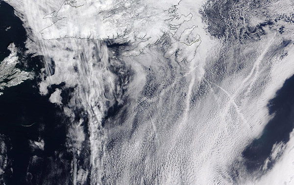
Ships traveling over the North Atlantic Ocean left their marks in the clouds in early February 2024. The Moderate Resolution Imaging Spectroradiometer (MODIS) on NASA’s Terra satellite acquired a true-color image of the cloudy scene south of the province of Newfoundland and Labrador, Canada on February 10.
Long, narrow lines crisscross a large bank of low-lying stratus cloud south of the eastern-most section of the island of Newfoundland. Called “ship tracks” or “ship trails,” these bright linear clouds are formed when water vapor condenses around tiny particles emitted by ships in their exhaust. As ships move, they give off fine particles (known as aerosols) and warm steam in their exhaust—perfect ingredients to create tracks visible from space. Clouds infused with ship exhaust have smaller and more droplets than clouds unaffected by the exhaust. The smaller droplets reflect more light than larger droplets, so they scatter light in many directions and appear brighter than the surrounding clouds.
Image Facts
Satellite:
Terra
Date Acquired: 2/10/2024
Resolutions:
1km (363.4 KB), 500m (1.7 MB), 250m (3.4 MB)
Bands Used: 1,4,3
Image Credit:
MODIS Land Rapid Response Team, NASA GSFC
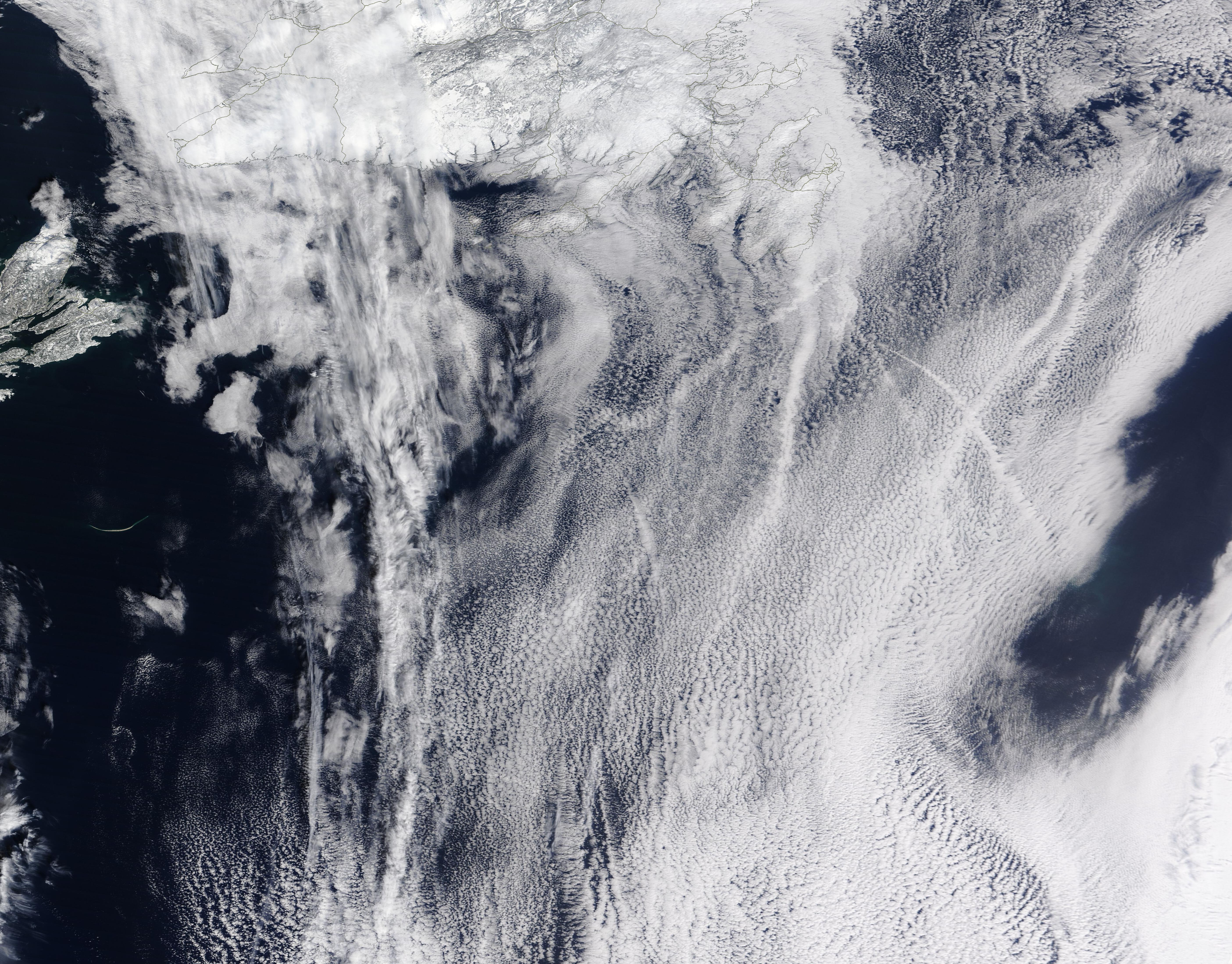
