
Images


March 10, 2024 - Hamun-e Jaz Murian
 Tweet
Tweet
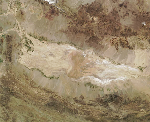
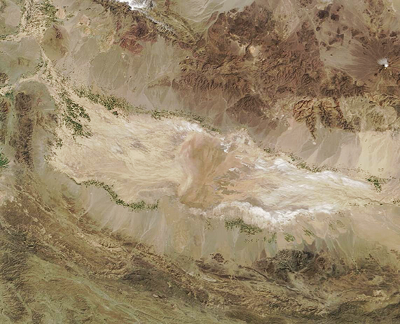
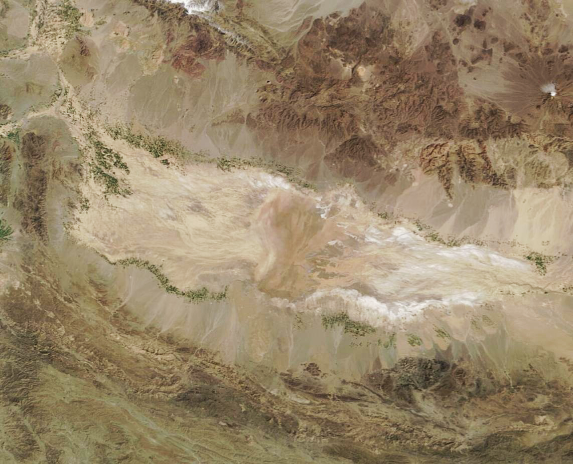
On March 3, 2024, the Moderate Resolution Imaging Spectroradiometer (MODIS) acquired a true-color image of the seasonal lake known as Hamun-e Jaz Murian. At that time, no water was visible within the lake or associated rivers and a bright white mineral crust outlined the edges of the dry basin. However, green vegetation appeared in patches scattered along the edges of Hamun-e Jaz Murian and nearby alluvial fans, giving evidence of the presence of life-giving water, even if it is not easily seen in this image.
Sitting in southeast Iran, the usually-bone-dry lakebed has been listed as one of the six major sources of dust emissions in southwest Asia along with the Karakum Desert, Dasht-e-Lut, the Margo and Registan Deserts, and the Sistan Basin. The lake fills the lowest points of the Jazmurian Basin in southeastern Iran and is surrounded by mountains. Mean annual precipitation is less than 100 mm (4 inches), although it rises to twice that amount in the western edge of the basin.
When heavy rains come to the surrounding mountains, two rivers, the Bampur and Halil Rud, can carry water into the Hamun-e Jaz Murian, causing it to flood. The last such flooding occurred in January 2022, when rare torrential rain and heavy snow brought severe floods to central and southern Iran, including the Jazmurian Basin and surrounding mountains.
Image Facts
Satellite:
Terra
Date Acquired: 3/3/2024
Resolutions:
1km (93.5 KB), 500m (245.1 KB), 250m (557.2 KB)
Bands Used:
Image Credit:
MODIS Land Rapid Response Team, NASA GSFC
