
Images


May 14, 2024 - Smoke from Canadian Wildfires Across North America
 Tweet
Tweet
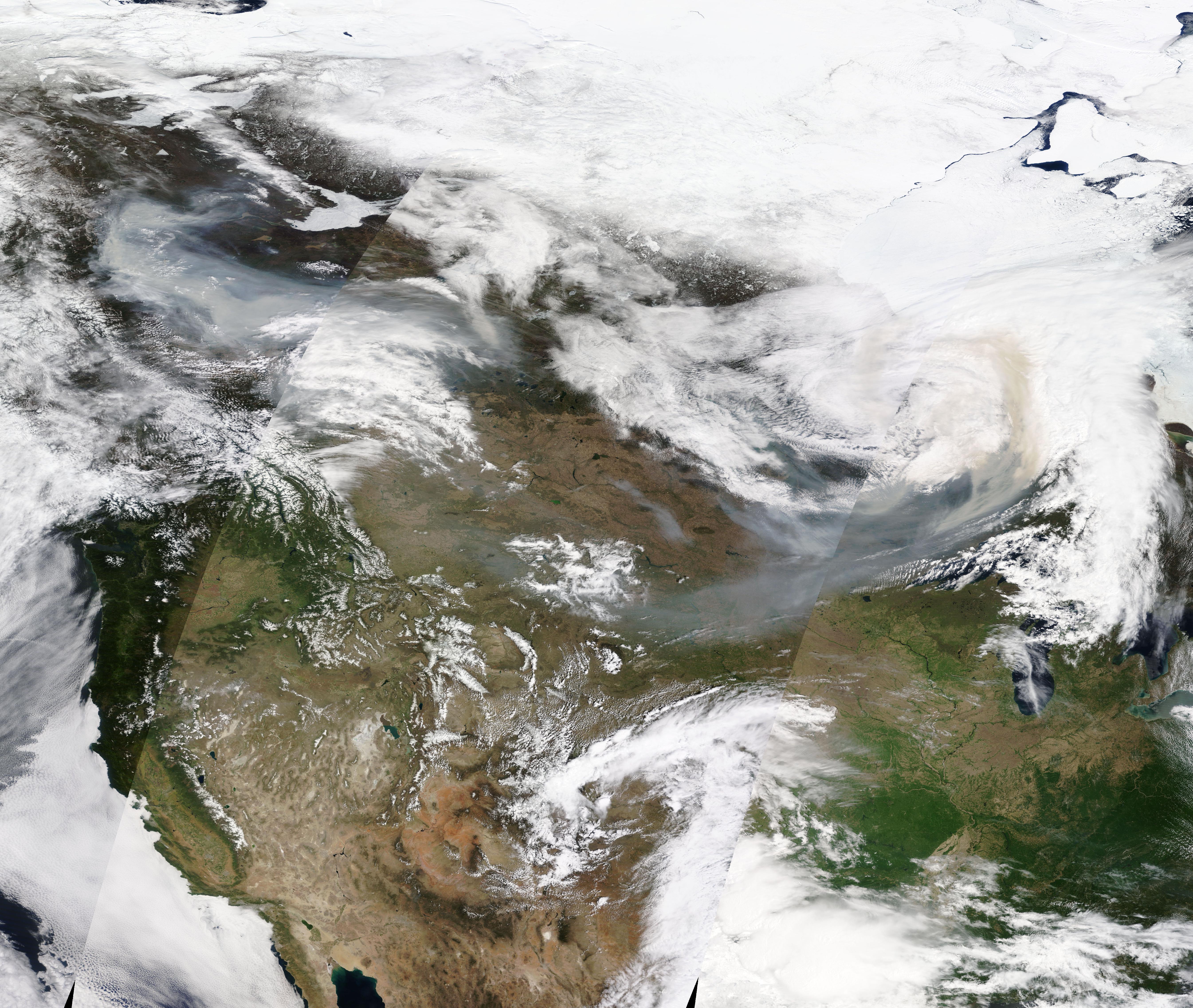
Following Canada’s extreme wildland fire season in 2023, unusually early and intense blazes are already raging in 2024. Though wildfire activity does not typically become widespread or intense in British Columbia until several weeks later in the summer, smoke already smothered parts of the western Canadian province in mid-May. Smoke has also dipped southward over the parts of the United States, impacting air quality in several states.
The Moderate Resolution Imaging Spectroradiometer (MODIS) on NASA’s Terra satellite acquired a true-color image of smoke billowing from several fires in British Columbia and Alberta, Canada, and pouring across both Canada and the United States on May 12. This image is a mosaic, which has stitched data from three passes of the satellite together to create a broad view across North America.
Smoke from western Canada, including several fires surrounding the community of Fort Nelson, British Columbia, was lofted several kilometers into the atmosphere and spread eastward. The smoke drifted, at times, into parts of the Upper Midwest and Great Lakes regions of the United States, triggering air quality concerns in several states.
According to AirNow.gov, on May 13, the Air Quality Index (AQI) for PM2.5 reached 162 in Crandon and Mosinee, Wisconsin, 159 in Wisner, Nebraska,156 in Ames, Iowa, and 151 in Marshall, Minnesota. These are all in the “Unhealthy” range for very fine particulates that can enter the lungs and be damaging to the health of people and animals. The AQI also reached “Unhealthy for Sensitive Groups” parts of South Dakota.
Image Facts
Satellite:
Terra
Date Acquired: 5/12/2024
Resolutions:
1km (3.8 MB),
Bands Used: 1,4,3
Image Credit:
MODIS Land Rapid Response Team, NASA GSFC
