Images


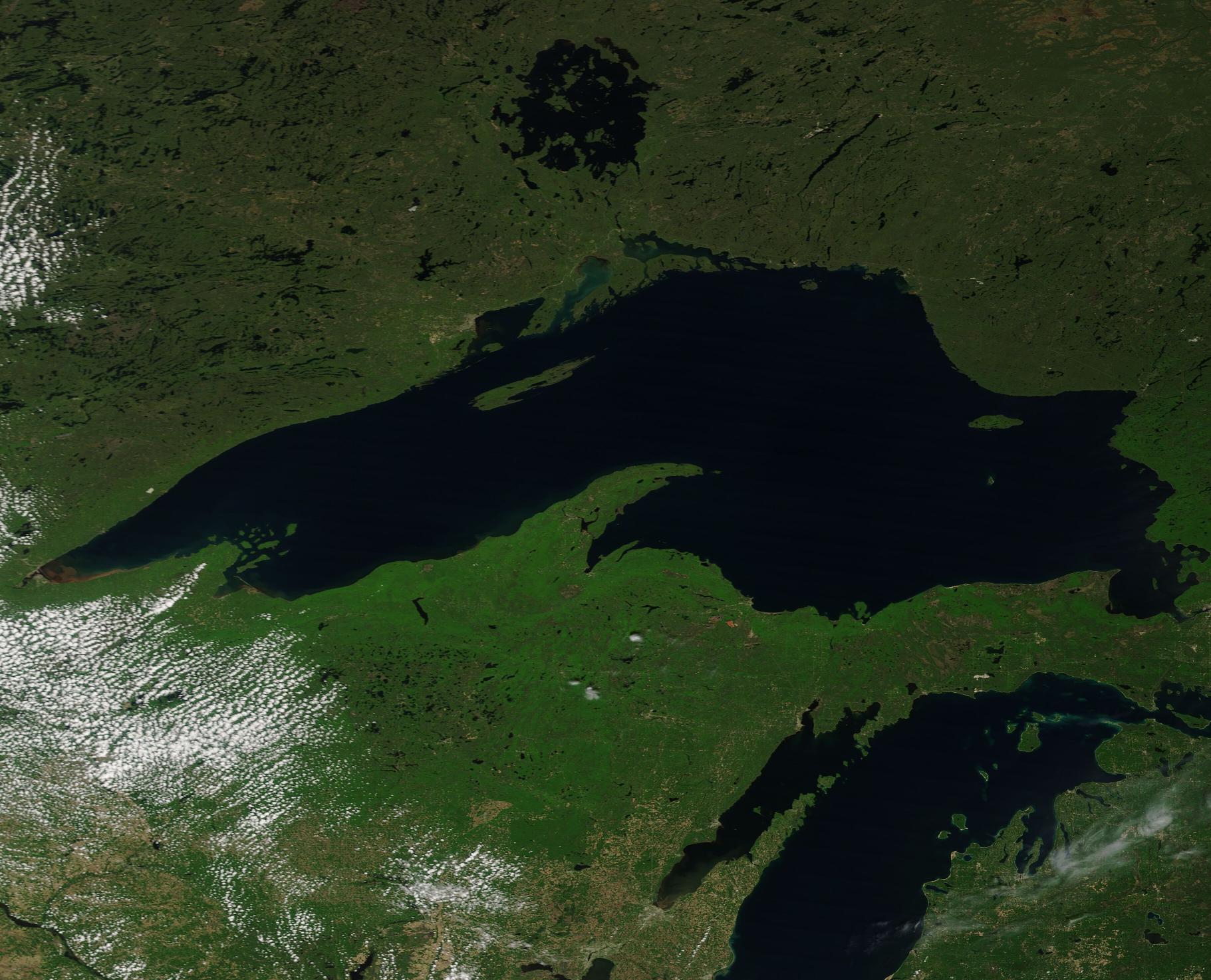
June 3, 2024 - Lake Superior
 Tweet
Tweet
On May 28, 2024, the Moderate Resolution Imaging Spectroradiometer (MODIS) on NASA’s Terra satellite acquired a true-color image of Lake Superior on a lovely, nearly cloud-free spring day. North of Lake Superior is the round Lake Nipigon and a bit of the northern reach of Lake Michigan is visible in the southern section of the image.
Lake Superior is the largest of the five North American Great Lakes, measuring about 160 miles (257 km) across wide and 350 miles (563 km) in length. The average depth is about 483 feet (147 meters), but the deepest point plunges to about 1,332 feet (406 meters).
The boundary between Canada (north) and the United States runs through the lake, making the shoreline shared by the province Ontario, Canada and the states of Wisconsin, Michigan, and Minnesota. The largest island in Lake Superior is Isle Royale, which belongs to the U.S. state of Michigan.
Image Facts
Satellite:
Terra
Date Acquired: 5/28/2024
Resolutions:
1km (104.5 KB), 500m (365.7 KB), 250m (1.1 MB)
Bands Used: 1,4,3
Image Credit:
MODIS Land Rapid Response Team, NASA GSFC
On May 28, 2024, the Moderate Resolution Imaging Spectroradiometer (MODIS) on NASA’s Terra satellite acquired a true-color image of Lake Superior on a lovely, nearly cloud-free spring day. North of Lake Superior is the round Lake Nipigon and a bit of the northern reach of Lake Michigan is visible in the southern section of the image.
Lake Superior is the largest of the five North American Great Lakes, measuring about 160 miles (257 km) across wide and 350 miles (563 km) in length. The average depth is about 483 feet (147 meters), but the deepest point plunges to about 1,332 feet (406 meters).
The boundary between Canada (north) and the United States runs through the lake, making the shoreline shared by the province Ontario, Canada and the states of Wisconsin, Michigan, and Minnesota. The largest island in Lake Superior is Isle Royale, which belongs to the U.S. state of Michigan.
Image Facts
Satellite:
Terra
Date Acquired: 5/28/2024
Resolutions:
1km (104.5 KB), 500m (365.7 KB), 250m (1.1 MB)
Bands Used: 1,4,3
Image Credit:
MODIS Land Rapid Response Team, NASA GSFC