
Images


August 18, 2024 - Ampil Spares Tokyo
 Tweet
Tweet
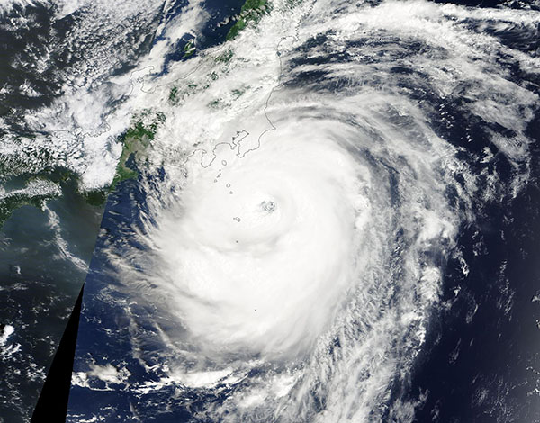
After making a beeline for Honshu Island, Typhoon Ampil veered to the northeast on August 16, 2024, brushing past Tokyo as it headed out to the open waters of the Pacific Ocean.
The Moderate Resolution Imaging Spectroradiometer (MODIS) on NASA’s Terra satellite acquired this true-color image of Ampil near its closest approach to Honshu. At that time, the severe cyclone sported a large, partially cloud-filled eye and convective bands were bringing torrential rain and wind to the Izu Islands. Leading convective bands were also beginning to impact the Tokyo region of Honshu.
According to the Japan Meteorological Agency (JMA), on 16 August at 6.00 UTC, the storm’s center was located near the coast of central Honshu Island, about 190 kilometers (118 miles) southeast of Tokyo. A little later in the day, near the time this image was captured, Typhoon Ampil’s maximum sustained winds peaked near 130 miles per hour ( 209 km/h), according to Zoom Earth. That would place it at the threshold of a Category 4 storm on the Saffir-Simpson Hurricane Wind Scale.
Media outlets reported that about 17,000 households had been evacuated across the Greater Tokyo Area and coastal central Honshu Island as the storm barreled toward Japan. Airlines cancelled flights, causing a disruption in travel. Ampil brought strong wind and heavy rain, despite staying offshore. Some flooding has been reported as well as concerns about the potential for landslides.
After turning away from Japan, Ampil quickly weakened. According to Zoom Earth, on the evening of April 17, maximum sustained winds had dropped to about 70 miles per hour (113 km/h), which brought it to tropical storm strength. It was heading northeast over the open Pacific Ocean and is forecast to become extratropical on August 18 as it continues to weaken.
Image Facts
Satellite:
Terra
Date Acquired: 8/16/2024
Resolutions:
1km (396.8 KB), 500m (1.2 MB), 250m (3.4 MB)
Bands Used: 1,4,3
Image Credit:
MODIS Land Rapid Response Team, NASA GSFC
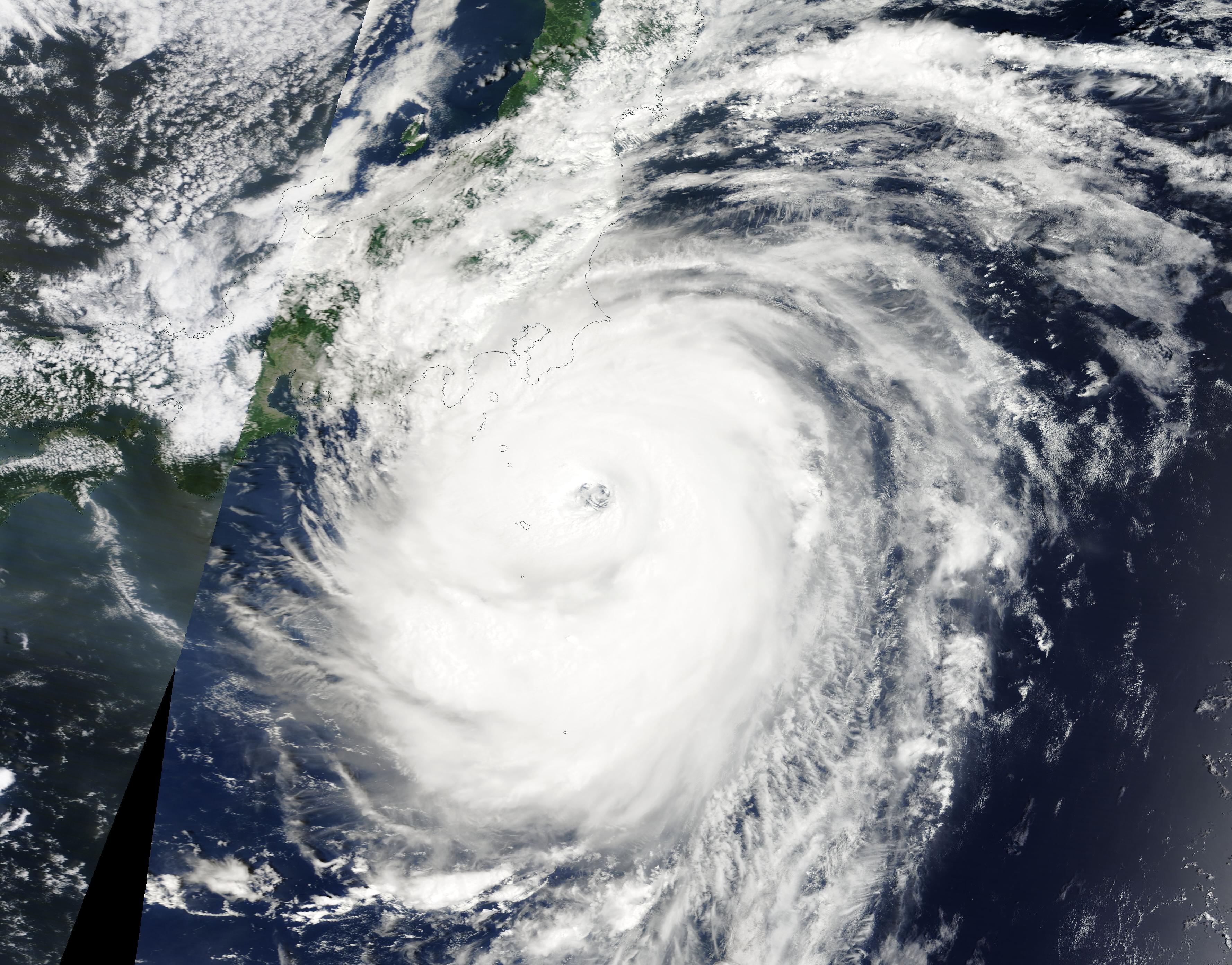
