
Images


December 2, 2024 - Snow in the Dakotas and Minnesota
 Tweet
Tweet
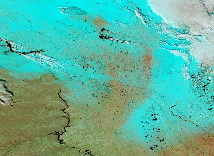
The first significant snowfall of the season coated parts of Minnesota and North Dakota as a winter storm blew across the northern United States from November 19-21, 2024. The icy blast brought 1 to 4 inches (2.5 – 10 cm) to western Minnesota, along with slick roads across the state. The swath of new snow measured 2-4 inches (5-10 cm) across much of North Dakota as well, with a full 10 inches (25 cm) reported at Boundary Lake north of Dunseith, North Dakota. Eastern South Dakota also received a light coating from this storm.
The region had experienced a relatively mild and dry fall, with snowfall nearly completely absent before late November. Substantial snow typically starts in North Dakota around the middle of October, according to local news reports. The November 19-21 storm ushered in wintertime weather, with additional snow falling intermittently through the end of the month.
The Moderate Resolution Imaging Spectroradiometer (MODIS) on NASA’s Aqua satellite acquired this false-color image of a swath of snow across Minnesota (at the left edge), North Dakota (north) and South Dakota (south). In this type of image, snow shows up as electric blue, while clouds look white, open land is tan, water appears deep blue, and vegetation is bright green. The Missouri River, which curves across the western section of the image, remains ice-free and thus gives evidence that temperatures have remained relatively warm for November in the Northern Tier.
Image Facts
Satellite:
Aqua
Date Acquired: 11/25/2024
Resolutions:
1km (388.9 KB), 500m (953.9 KB), 250m (1.3 MB)
Bands Used: 1,4,3
Image Credit:
MODIS Land Rapid Response Team, NASA GSFC
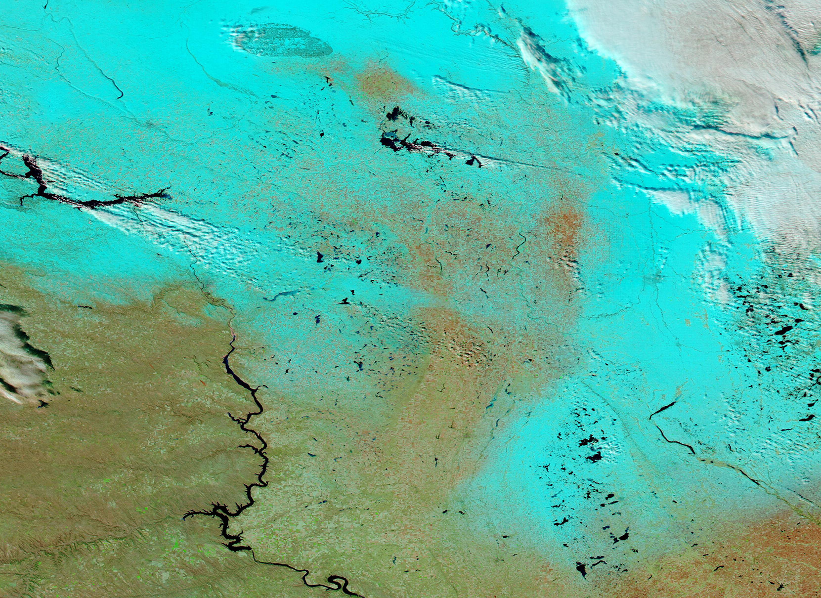
