
Images


January 29, 2025 - Ice on Lake Erie
 Tweet
Tweet
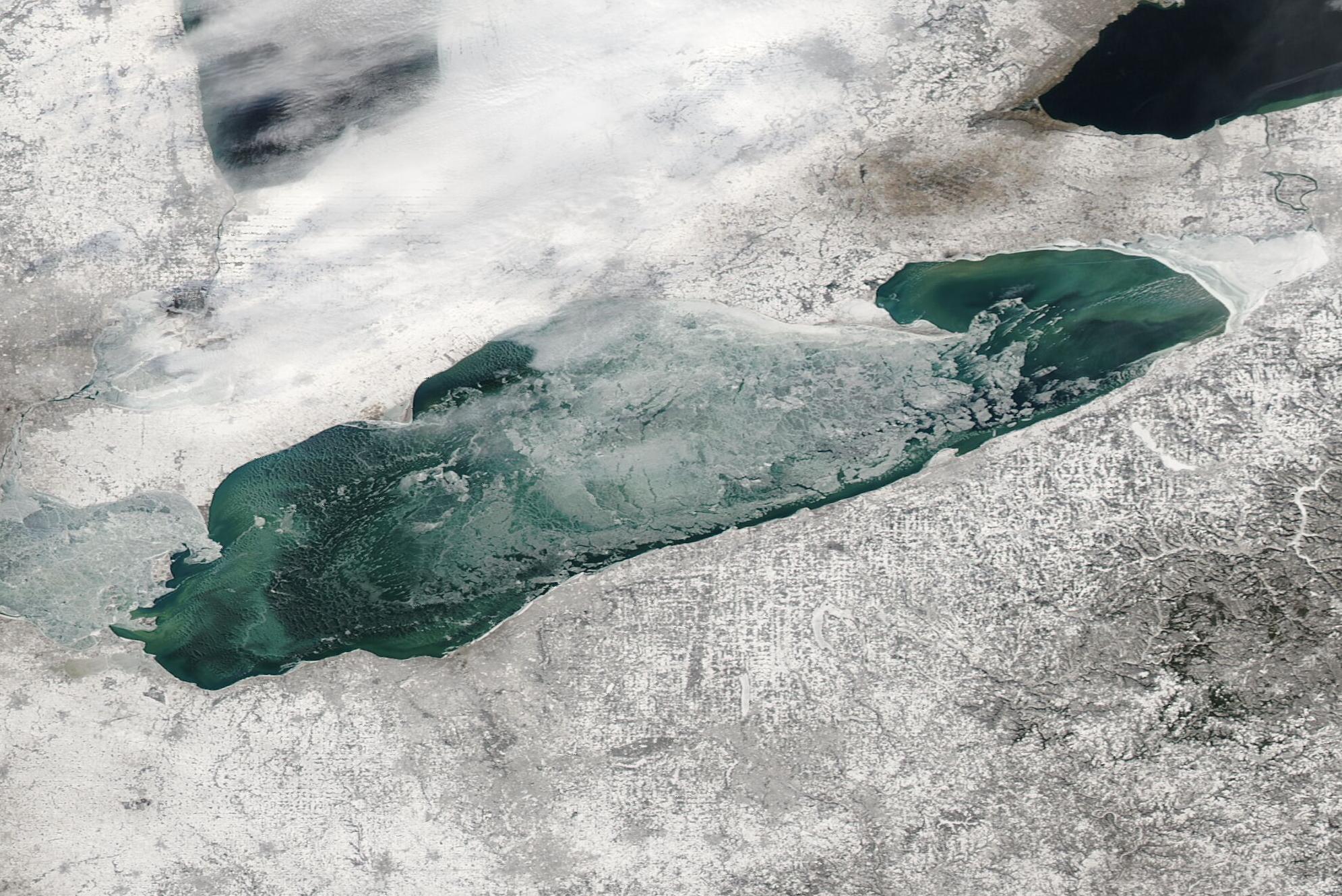
Fiercely cold winds swept across the Great Lakes in January 2025, spurring a rapid growth of lake ice. Air temperatures in Toledo, Ohio and Erie, Pennsylvania plummeted from highs near 50°F (10°C) in the closing days of December 2024 to well below freezing mid-month. On January 22, Erie experienced lows of -5°F (-20.6°C) and, on the other end of Lake Erie, thermometers registered -3°F (-19.4°C) in Toledo.
By January 25, Lake Erie responded to the deep Arctic blast by undergoing a rapid ice-up, with ice covering up to 86 percent of the lake, according to data from the National Oceanic and Atmospheric Administration (NOAA). This is well above average ice cover for this time of year, and above the annual peak average ice coverage, which typically occurs in mid-February.
The Moderate Resolution Imaging Spectroradiometer (MODIS) on NASA’s Aqua satellite acquired this true-color image of ice on Lake Erie on January 27. The far western section of the lake, near Toledo, was covered in fast ice (ice that sticks to the shoreline) as was a smaller section of ice on the eastern edge, near Erie.
By January 27, total ice cover had decreased from the January 25 peak, due to a combination of warming air, sunshine, and strong wind. Wind gusts of up to 58 miles per hour (93 km/h) were reported at Niagara Falls, near the east side of the lake, with frequent gusts in the 35-46 mph (56-74 km/h) measured on January 26-27. Strong winds push drifting ice, frequently causing it to pile up, resulting in increased open water.
Image Facts
Satellite:
Aqua
Date Acquired: 1/27/2025
Resolutions:
1km (115.5 KB), 500m (346.9 KB), 250m (479.1 KB)
Bands Used: 1,4,3
Image Credit:
MODIS Land Rapid Response Team, NASA GSFC
