
Images


February 1, 2025 - Fires in Central Africa Republic
 Tweet
Tweet
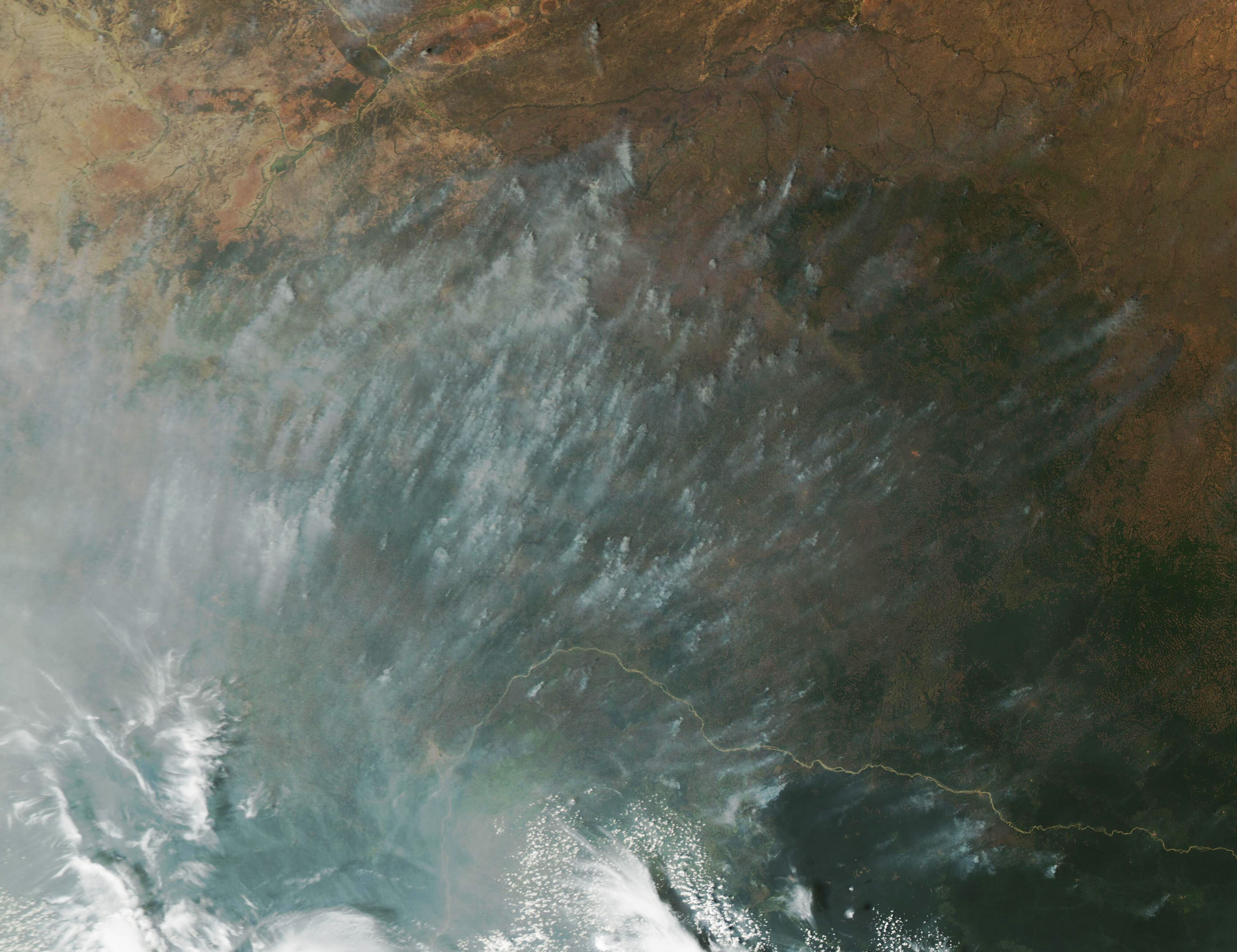
On January 27, 2025, the Moderate Resolution Imaging Spectroradiometer (MODIS) captured this true-color image of smoke smothering a portion of the Central African Republic. Dozens of bands of thick gray smoke streaked the skies, likely blown by winds from an incoming storm, while a thick gray pall accompanied the storm clouds in the southwest.
Given the location, the time of year, and the abundance, the smoke most likely originated from agricultural fires, which are fires used to manage cropland and pasture. This can range from clearing the stubble from old fields, to preparing new plantings, to freshening pastureland, to slash-and-burn techniques that bring down forest to create new land for human use. Some of the fires could also be wildfires, including those that began as agricultural fires and slipped control.
The Central African Republic has three different types of vegetation that are generally arranged in lateral bands moving from the north to the south. There are dry savannahs in the north, wet savannas in the center, and humid forests which tend to cluster in the south. Most of the vegetation is at least fire resistant, while a large part of the savanna is reliant on intermittent fires to maintain the ecosystem.
According to a report by the Food and Agriculture Organization of the United Nations (FAO), fire activity usually starts in the northeast of the country about November and moves southwest following Harmattan winds—dry, dusty northeasterly winds that sweep across Africa. The fire season in the Central African Republic reaches a peak in December or early January and usually is extinguished in March as the wet season rains begin.
Image Facts
Satellite:
Aqua
Date Acquired: 1/27/2025
Resolutions:
1km (327.2 KB), 500m (733.9 KB), 250m (1.4 MB)
Bands Used: 1,4,3
Image Credit:
MODIS Land Rapid Response Team, NASA GSFC
