
Images


March 8, 2025 - Dust over the Mediterranean Sea
 Tweet
Tweet
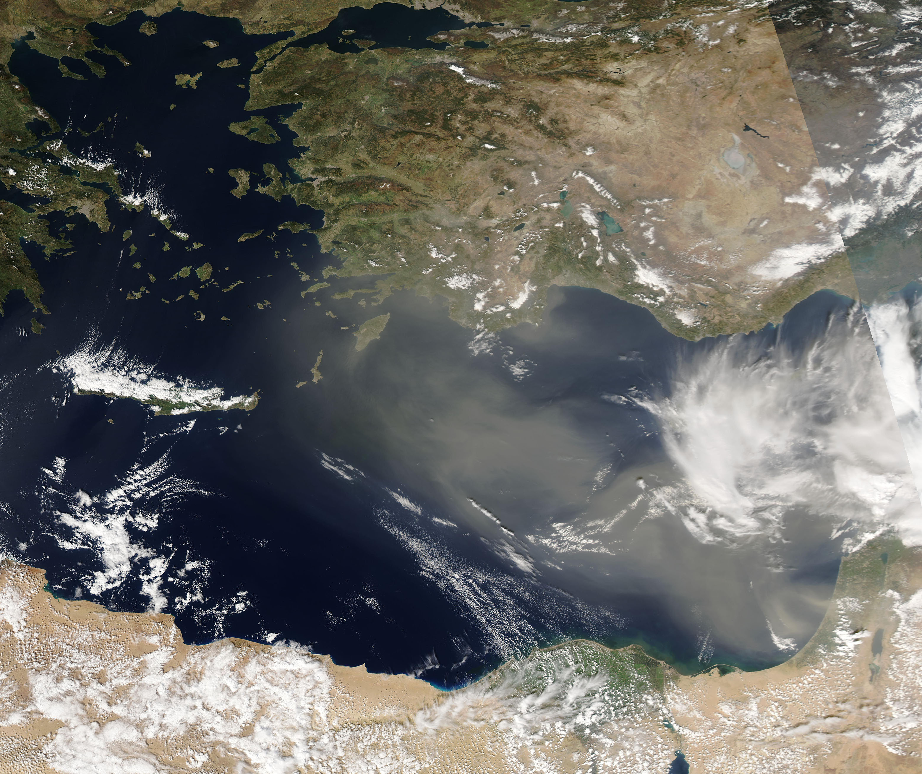
A thick blanket of dust blew over the eastern Mediterranean Sea in early March 2025. Strong winds began to raise dust from northern Africa’s Sahara Desert on March 3-4. By March 5, when the Moderate Resolution Imaging Spectroradiometer (MODIS) acquired this true-color image, the winds had shifted to stream dust from the Arabian Peninsula. That was the same day that the four-day-long storm reached its peak, with streaming dust reaching the shores of southern Turkey and covering the island of Cyprus.
The government of Cyprus published an advisement of a dust episode affecting the island. It stated that high concentrations of dust were observed in the air on March 5, according to measurements from ground Stations of the Air Quality Monitoring Network operated by the Department of Labour Inspection. The public, especially vulnerable groups (children, older people, and the infirm) were urged to avoid open spaces until the episode had passed, warning that the small size of respirable particles in dust may have negative effects on human health. Workers in open spaces were also recommended to use appropriate means of personal protection. At 9:00 a.m. local type, the highest reading of PM10 was 108.6 μg/m3 at Paphos, Cypris, more than twice the daily limit of 50 μg/m3 deemed legal exposure, according to the published report. PM10 refers to tiny particles that measure less than 10 μg in size, making it small enough to move into the lungs and trigger respiratory problems.
Dust outbreaks are common over the Mediterranean Sea during any time of the year. The peak frequency occurs in spring (March, April, and May).
Image Facts
Satellite:
Aqua
Date Acquired: 3/5/2025
Resolutions:
1km (477.9 KB), 500m (1.4 MB), 250m (2.9 MB)
Bands Used: 1,4,3
Image Credit:
MODIS Land Rapid Response3/5/2025 Team, NASA GSFC
