
Images


April 17, 2025 - Severe Dust Storm in the Middle East
 Tweet
Tweet
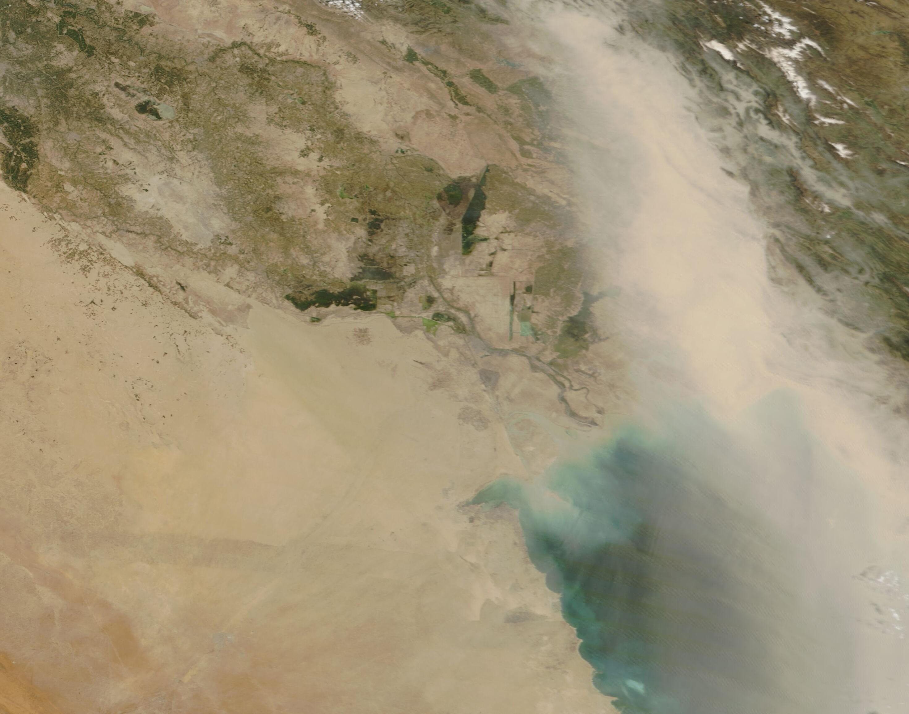
A widespread and severe dust storm swept across much of the Middle East in mid-April 2025.
Dust began to fly on April 14, when the Meteorological Department of that country was quoted as advising that the horizontal visibility “has dropped to less than 100 meters and is zero in some areas” and stressed that people should not leave their homes except in extreme emergency. On that same day, strong winds carried dust across southern Iraq, forcing flight delays at Basra International Airport.
The dust storm widened on April 15, blanketing both central and southern Iraq, part of Iran, Saudi Arabia, and the United Arab Emirates (UAE). According to a story published by AQI on their website, visibility in Iran dropped to less than 1 kilometer (0.6 miles). Airports in both Najaf and Basra were closed and thousands of people suffered breathing problems. A red-level alert was issued in Iran’s Khuzestan province, where twenty people were hospitalized. Dust-laden winds in the UAE reached 40 kilometers per hour (25 mph) and visibility also dropped to less than 1 kilometer (0.6 miles).
The Moderate Resolution Imaging Spectroradiometer (MODIS) on NASA’s Terra satellite acquired this true-color image of the massive, dangerous dust storm on April 15. The heaviest dust blows southward in a wide river west of Iran’s Zagros Mountains and thins somewhat as it spreads over the Persian Gulf. This plume of dust is so thick that it completely obscures the ground beneath it. Dust is also present in skies over the southern Iraq, Kuwait, and Saudi Arabia, all southwest of the thickest dust.
Image Facts
Satellite:
Terra
Date Acquired: 4/15/2025
Resolutions:
1km (150 KB), 500m (320.1 KB), 250m (648.2 KB)
Bands Used: 1,4,3
Image Credit:
MODIS Land Rapid Response Team, NASA GSFC
