Images
December 18, 2018 - Tropical Cyclone Phethai
Tweet
Tropical Cyclone Phethai formed from a depression over the southern Bay of Bengal on December 15, 2018. The sixth named cyclone of the 2018 North Indian Ocean cyclone season, the storm proved to be a short-lived rainmaker for Andhra Pradesh, India.
On December 17 at 0:00 UTC (5:30 a.m. local time/Chennai, India or 7:00 p.m. December 16 EST), the center of Phethai was located about 87 mi (140 km) south of Katrenikona Town and 118 mi (190 km) south of Kakinada City (north-east Andhra Pradesh) with maximum sustained winds of 51.5 mph (83 km/h).
Tropical Cyclone Phethai strengthened slightly before making landfall in the East Godavari district of Andhra Pradesh in the late afternoon of December 17. The storm brought heavy rain to the region and high surf along the coast. Once over land the storm quickly weakened as it moved over northern Andhra Pradesh, with the Joint Typhoon Warning Center (JTWC) issuing its last advisory late in the day of December 17 (early morning December 18 in India).
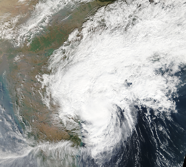
On December 17 the Moderate Resolution Imaging Spectroradiometer (MODIS) on board NASA’s Terra satellite acquired a true-color image of Tropical Cyclone Phethai. The center of the system appears to have already made landfall while heavy clouds carry rainfall across the region.
Image Facts
Satellite:
Terra
Date Acquired: 12/17/2018
Resolutions:
1km (2.9 MB), 500m (7.9 MB), 250m (6.5 MB)
Bands Used: 1,4,3
Image Credit:
MODIS Land Rapid Response Team, NASA GSFC


