
Images


July 23, 2024 - Nile River Delta
 Tweet
Tweet
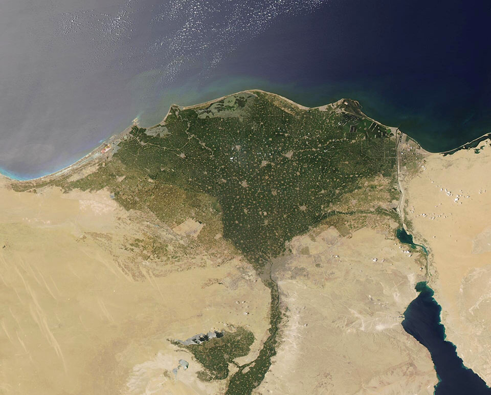
The longest river in Africa, the Nile flows more than 4,100 miles (6,650 kilometers) northward from the equator to reach the Mediterranean Sea. As it passes the city of Cairo, Egypt, the main channel breaks into two distributaries, the Damietta and the Rosetta Rivers. The multiple channels and wetlands between those rivers create a broad, green fan filled with rich, moist soil that ultimately spills fresh water into the saline Mediterranean.
The Moderate Resolution Imaging Spectroradiometer (MODIS) on NASA’s Aqua satellite acquired a true-color image of the Nile Delta on July 13, 2024.
In the image, the Nile can be seen flowing through a corridor of green. It passes near the town of Faiyum, which sits on the green patch near Qarun Lake. Moving north, a large patch of tan and gray marks the city of Cairo, home to more than 7.7 million people in 2023, according to Worldometer. The fertile green plains of the Delta, once primarily used for agriculture, are studded with gray circles that represent cities. They are connected by lines, which are roadways.
Also visible to the east of the Delta is the Suez Canal. This busy shipping route connects Port Said, located on the Mediterranean Sea, to the Gulf of Suez. The Gulf is an arm of the Red Sea. Only 105 nautical miles in length, the Suez Canal is monumentally important. It has been estimated that the canal carries about 12 percent of the world’s trade each year, as well as 30 percent of all of the Earth’s container ship traffic each year.
Image Facts
Satellite:
Aqua
Date Acquired: 7/13/2024
Resolutions:
1km (61.9 KB), 500m (173.3 KB), 250m (380.4 KB)
Bands Used: 1,4,3
Image Credit:
MODIS Land Rapid Response Team, NASA GSFC
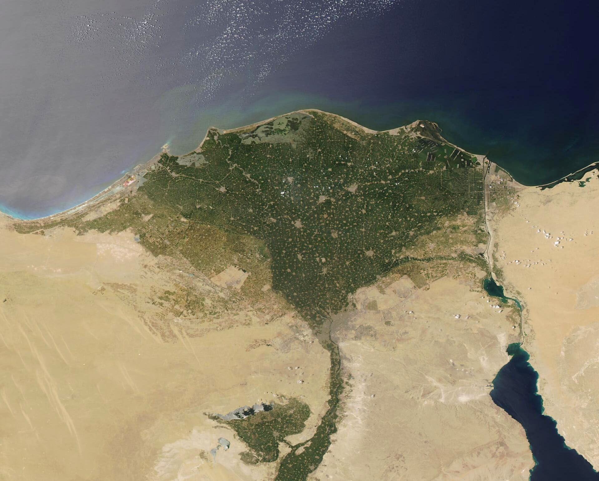
