
Images


July 17, 2024 - Western Cuba and the Colorados Archipelago
 Tweet
Tweet
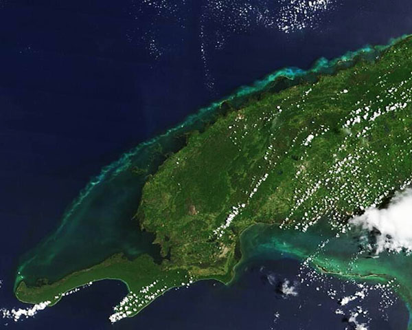
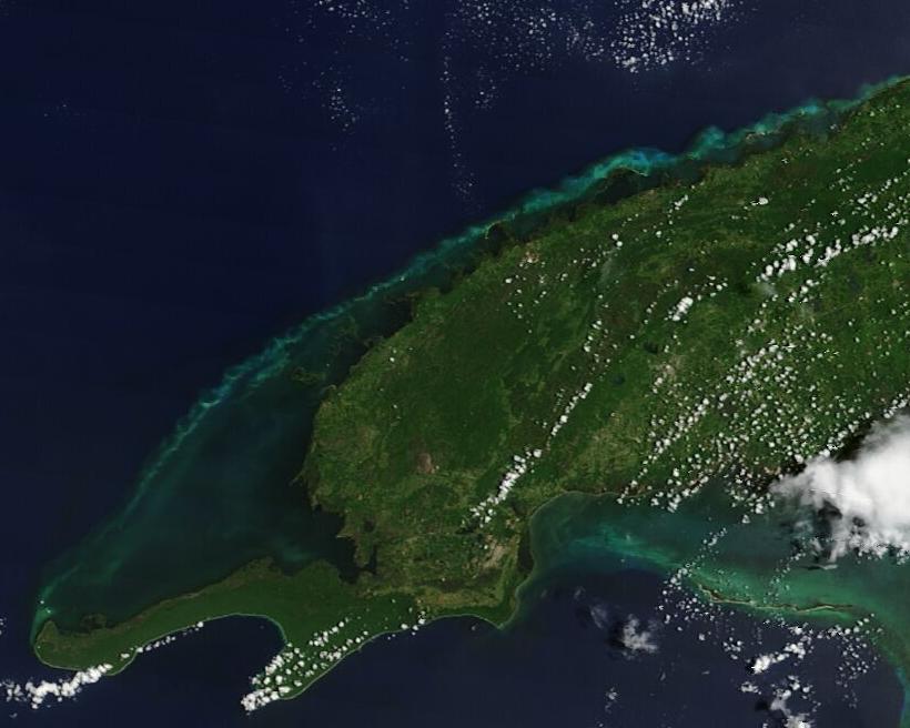
Summer colors sparkled off the coast of Cuba in mid-July 2024 as the mainland glowed in verdant green. The Moderate Resolution Imaging Spectroradiometer (MODIS) on NASA’s Terra satellite acquired this true-color image of western Cuba on July 16.
The image centers on the Pinar Del Rio Province, the western-most province of Cuba. The province is known for its rich farmland which produces, among other crops, tobacco which is used for Cuban cigars. It has also been touted as a great place to scuba dive, with multiple sites just offshore, especially along the northern coast. The mountainous landscape folds into uniquely rounded limestone hills in some locations.
Off the northern coast lies a stretch of cays and islets which are associated with a barrier reef facing the Gulf of Mexico. This area is known as the Colorados Archipelago. It is roughly 100 kilometers (62 miles) in length and provides a critical home and spawning ground for many species of fish and marine life, including endangered hawksbills turtles as well as commercial fishes such as grouper and snapper.
In 2022, Cuba announced that it had protected much of the sensitive and biodiverse region as a Marine Protected Area (MPA). Named the Este del Archipiélago de Los Colorados (East of Los Colorados Archipelago), the reserve protects about 728 square kilometers (281 square miles) of mangrove forests, seagrass beds, and coral reefs. One-third of the MPA has also been designated the Corona San Carlos Wildlife Refuge, where no fishing will be allowed at any time. The rest of the MPA will allow limited and restricted fishing at times.
Image Facts
Satellite:
Terra
Date Acquired: 7/16/2024
Resolutions:
1km (27.5 KB), 500m (47.9 KB), 250m (58.9 KB)
Bands Used: 1,4,3
Image Credit:
MODIS Land Rapid Response Team, NASA GSFC
