
Images


July 24, 2024 - Clear Skies over Svalbard Archipelago
 Tweet
Tweet
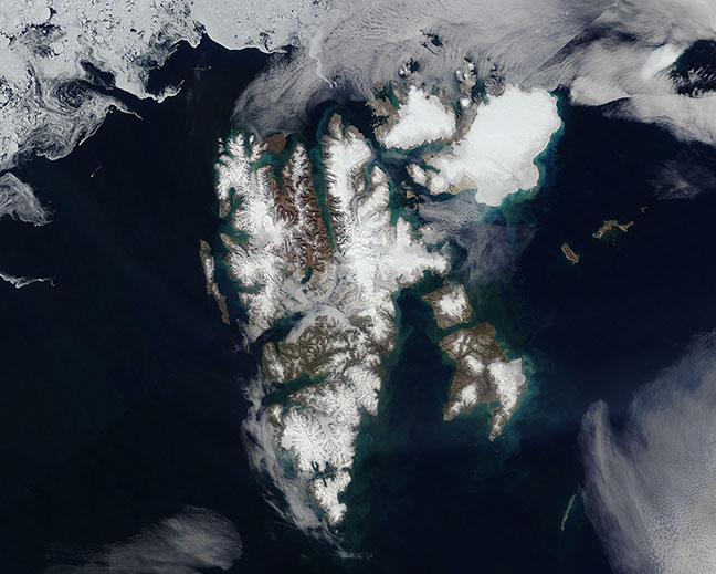
Beautifully clear skies allowed the Moderate Resolution Imaging Spectroradiometer (MODIS) on NASA’s Terra satellite to acquire a gorgeous true-color image of the Svalbard Archipelago on July 17, 2024.
This group of ice-coated islands, which belongs to Norway, sits north of mainland Europe and halfway between Norway and the North Pole. It is surrounded by the Arctic Ocean (north), Barents Sea (southeast), Greenland Sea (southwest), and the Norwegian Sea. There are nine main islands, including Spitsenbergen, which is the largest, as well as North East Land, Edge Island, Barents Island, Prins Karls Foreland, Kvit Island, Kong Karls Land, Bjorn (Bear) Island and Hopen.
In this image, sea ice covers the Arctic Ocean and snow and ice sit atop most of the landmass. Some clouds are visible in the south, and it appears that some fog (low cloud) covers valleys in central Spitsbergen. Ice remains atop Svalbard’s islands year-round, although sea ice cover was exceptionally low in the summer of 2023 due to unusually high air temperatures.
Image Facts
Satellite:
Terra
Date Acquired: 7/17/2024
Resolutions:
1km (96.5 KB), 500m (286.4 KB), 250m (656.5 KB)
Bands Used: 1,4,3
Image Credit:
MODIS Land Rapid Response Team, NASA GSFC
