
Images


August 28, 2024 - Tropical Storm Hone Impacts Hawaii
 Tweet
Tweet
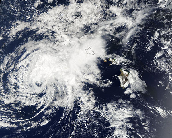
Hurricane Hone brought soaking rains and high surf to Hawaii when it passed south of the island chain on August 25, 2024. At 1500 UTC (11:00 a.m. EDT), the storm reached its peak strength as a Category 1 hurricane with maximum sustained winds of 85 miles per hour (140 km/h). At the same time, Hone was located only 115 miles (190 km) southwest of the city of Hilo and 240 miles (385 km) south-southeast of Honolulu. Hilo sits on the island of Hawaii and Honolulu, the state capital and most populated city in Hawaii, is located on the island of O’ahu.
The close pass disrupted power to tens of thousands of customers, cancelled flights, flooded roads, and closed schools, according to Hawaii News Now. In addition, on the island of Maui, a home in Maui lost its roof from high winds, downed trees and telephone poles disrupted traffic, and a landslide was reported on the Hana Highway . Several shelters (all pet-friendly) were open on the island of Hawaii ahead of the storm and remain open for those without electricity.
The Moderate Resolution Imaging Spectroradiometer (MODIS) on NASA’s Terra satellite acquired a true-color image of Hone on August 26, as it was weakening as it tracked past the islands. Reduced to tropical storm strength, the storm had become asymmetric with a large, open eye. Convective bands were still bringing rain to several islands, including Kauai and O’ahu.
While Hawaii takes a collective sigh that Hurricane Hone has passed, more storms are brewing to the east. Trailing a few thousand kilometers behind Hone is Gilma, a disturbance that had grown to Category 3 strength on August 25. Gilma has been steadily weakening as it approaches the northern side of the Hawaii Islands. Forecasters expect the storm to continue to weaken as it encounters an environment with higher wind shear, cooler water temperatures, and dry air.
Ever farther to the east, Tropical Storm Hector formed on August 25 and began to track westward following a path very close to Gilma’s. The storm reached peak strength the next day, with maximum sustained winds of 50 miles per hour (80.5 km/h). It has since weakened and, like Gilma, forecasters expect Hector to weaken in the coming days as it encounters unfavorable conditions.
Image Facts
Satellite:
Terra
Date Acquired: 8/26/2024
Resolutions:
1km (331 KB), 500m (1 MB), 250m (2.8 MB)
Bands Used: 1,4,3
Image Credit:
MODIS Land Rapid Response Team, NASA GSFC
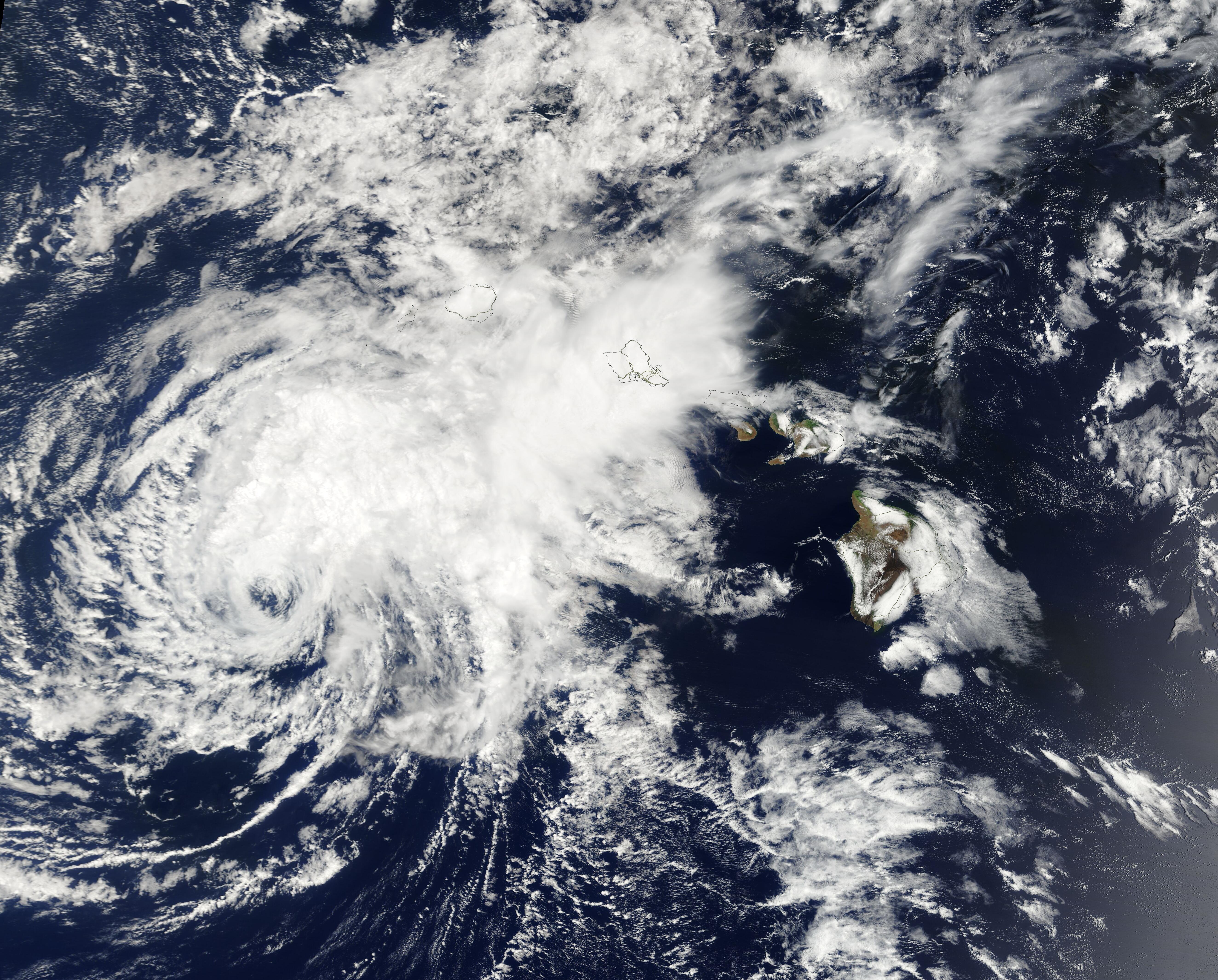
