
Images


October 23, 2024 - Fresh Snowfall on Wildfires in Western Wyoming
 Tweet
Tweet
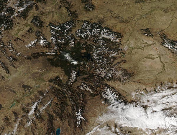
A winter-like storm that moved across western Wyoming on October 17-18, 2024, dropped temperatures and fresh snow across the region, helping to subdue two major wildfires. After months of weather classified as Very High Fire Danger (high air temperatures, low humidity, and high winds), the change was a welcome aid to firefighters those living near the Elk and Pack Trail Fires.
The Elk Fire ignited from lightning strikes on September 27. As of October 17, it had burned more than 96,000 acres in the Bighorn National Forest in northern Wyoming. On October 17, local media reported that the southern side of the fire had received the equivalent of 0.4 inches of rain, while the northern end received one inch. The fire did not grow on that date and additional precipitation (snow) was expected. As of October 22, InciWeb Incident Information System reports that the Elk Fire had burnt a total of 96,360 acres and was considered 51 percent contained. The report also noted that the snow had melted and that pockets of heat still persist, resulting in creeping and smoldering behavior with some individual trees igniting. The weather is helping firefighting activity but flareups are still expected.
The Pack Trail Fire was also caused by lightning and was discovered September 15 south of Moran, Wyoming. It is located in both the Bridger-Teton National Forest and the Shoshone National Forest. On October 17, local media reported that the fire covered more than 88,000 acres. On October 22, InciWeb increased that number to 89,639 acres and considers the perimeter zero percent contained. Fire activity was reported as minimal but is expected to increase over the next few days as the fuel begins to dry. There is a potential for additional snow and cooler temperatures from a system forecast for October 25-26 in the region, which will once again aid firefighters.
The daily incident report for the Park Trail Fire gives the following caution, “Despite the recent precipitation, Teton Interagency Fire Managers are maintaining the Very High Fire Danger Rating for Grand Teton National Park, the Bridger-Teton National Forest, the Shoshone National Forest, and the National Elk Refuge. This precipitation was not a fire season ending event. Due to wind, fuels will begin to rapidly dry out when the snow melts. Any spark can ignite fire which can grow rapidly into a major incident. Residents and visitors are reminded to exercise extreme caution with fires or other possible ignition sources.”
The Moderate Resolution Imaging Spectroradiometer (MODIS) on NASA’s Aqua satellite acquired this true-color image of fresh snowfall atop the mountains of western Wyoming on October 20. Yellowstone Lake can be seen near the center of the image. The Park Trail Fire is located southeast of Yellowstone Lake, roughly halfway between the lake and snow-covered Gannet Peak. While not easy to see in this image, the dampened burn scar from the Park Trail Fires appears as a mixture of brown and brick red. No actively burning fire is evident in this image.
Image Facts
Satellite:
Aqua
Date Acquired: 10/20/2024
Resolutions:
1km (83.8 KB), 500m (291.1 KB), 250m (881.1 KB)
Bands Used: 1,4,3
Image Credit:
MODIS Land Rapid Response Team, NASA GSFC
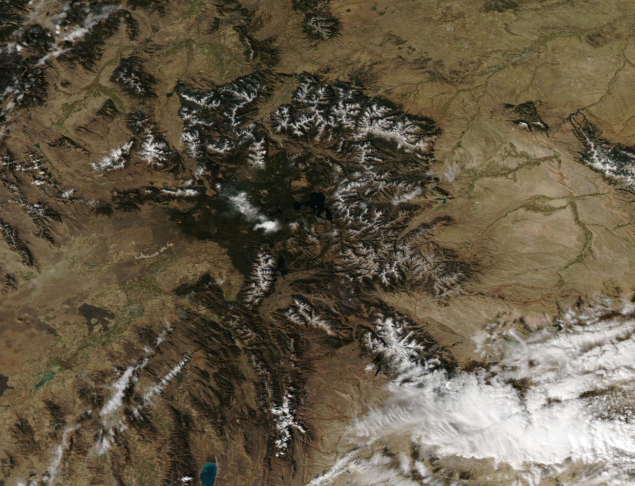
