
Images


May 16, 2025 - Sunglint over the Mediterranean
 Tweet
Tweet
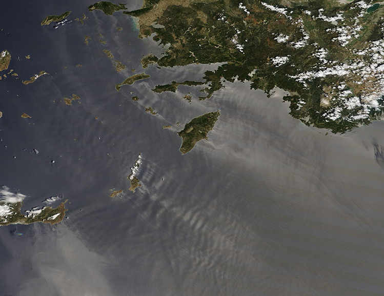
On May 14, 2025, the Moderate Resolution Imaging Spectroradiometer (MODIS) on NASA’s Terra satellite acquired this true-color image of sunglint revealing ruffled waters across a portion of the northeastern Mediterranean Sea. The large island is Rhodes, Greece while the landmass in the northeast belongs to Türkiye.
Sunglint is an optical phenomenon where sunlight bounces from smooth water directly toward the satellite’s imager, creating a bright silvery-gray sheen. In contrast, areas where water is rougher looks darker because light is scattered in many more directions and little reflects directly back to the satellite.
This image captures a moment where strong winds blew from the northwest across several islands. As the winds approach the tall islands, the surface of the water is disturbed so the sea looks dark. Where the islands nearly completely block the wind, the water on the leeward side is smooth, resulting in bright sunglint and gray colors. Light-then-dark streaks behind the islands mark areas of smooth-then-rough sea surfaces. This is likely the result of fiercely gusting wind creating turbulence behind the islands, or possibly from a crosswind rippling the water surface.
This region is frequently combed by cool, dry winds that roar in from the north. Known as “Etesian winds”, they usually originate from air masses over southern Russia or the Caspian Sea and sweep southward. They may come on suddenly and can reach gale force (62-74 km/h or 39-46 mph).
Image Facts
Satellite:
Terra
Date Acquired: 5/14/2025
Resolutions:
1km (192.6 KB), 500m (497 KB), 250m (302.8 KB)
Bands Used: 1,4,3
Image Credit:
MODIS Land Rapid Response Team, NASA GSFC
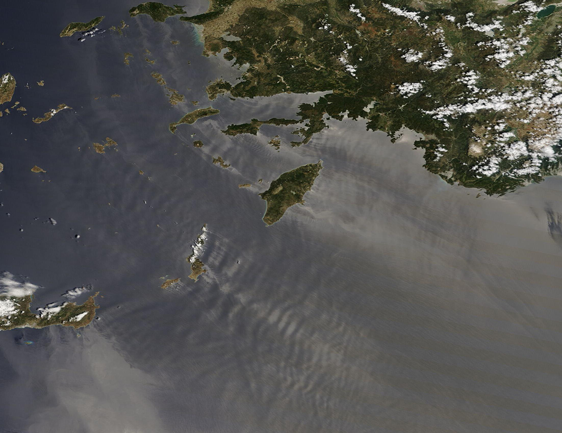
