
Images


March 14, 2015 - Saharan dust over the Atlantic Ocean
 Tweet
Tweet
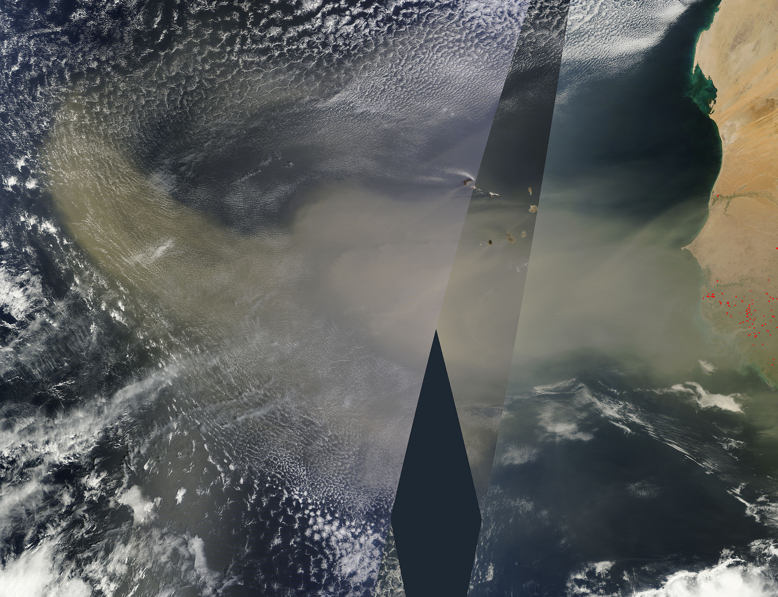
Sheets of Saharan dust pouring over the Atlantic Ocean from western Africa had reached approximately half-way to South American as February, 2015 came to a close. The trail of dust was so long that it required multiple swaths collected from the Moderate Resolution Imaging Spectroradiometer (MODIS) on both the Aqua and Terra satellites to be pieced together to create this extensive true-color image. The data was collected by the MODIS instrument as the satellites passed over the flowing dust on February 28.
The dust storm began on February 26, when massive clouds of dust rose from Senegal, Mauritius and Gambia and moved offshore. By February 27 the dust covered the Cape Verde Islands; an image acquired by the MODIS instrument on the Terra satellite was published as the MODIS Image of the Day on March 12.
Hundreds of millions of tons of sand and dust particles are lifted from North African deserts each year and carried across the Atlantic Ocean, often reaching the Amazon rainforest and even North America.
Image Facts
Satellite:
Date Acquired: 2/28/2015
Resolutions:
1km (1.8 MB), 500m (6.1 MB), 250m ( B)
Bands Used: 1,4,3
Image Credit:
Jeff Schmaltz, MODIS Land Rapid Response Team, NASA GSFC
