
Images


July 6, 2024 - Hurricane Beryl Impacts the Yucatan Peninsula
 Tweet
Tweet
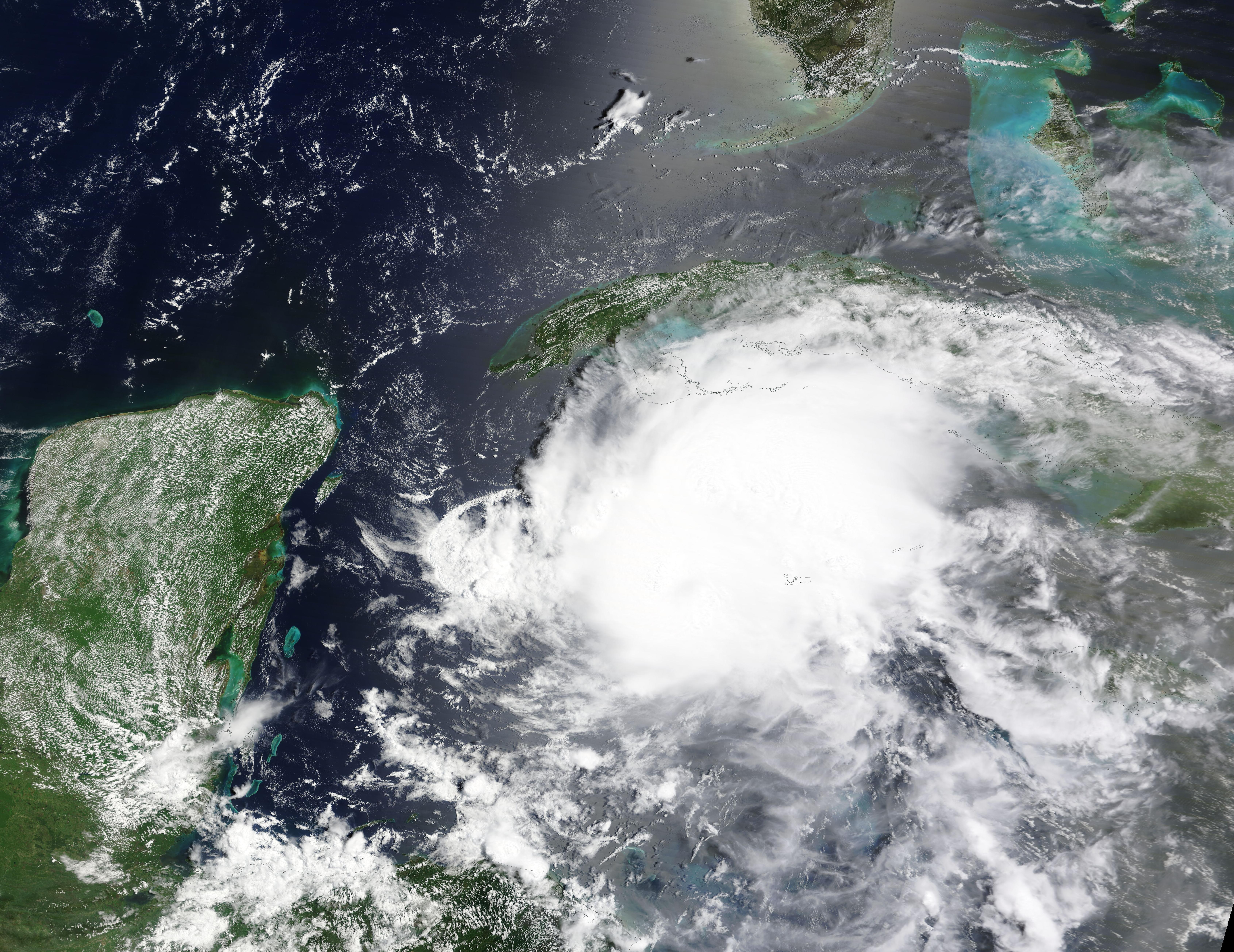
Hurricane Beryl was barreling towards a landfall on Mexico’s Yucatan Peninsula when the Moderate Resolution Imaging Spectroradiometer (MODIS) on NASA’s Aqua satellite acquired this true-color image on July 4, 2024.
Near the time the image was acquired, Beryl carried maximum sustained winds of about 100 miles per hour (175 km/h) according to the National Hurricane Center (NHC). That windspeed placed it at the very top end of a Category 2 storm on the Saffir-Simpson Hurricane Wind Scale. It was located about 215 miles (345 km) east-southeast of Tulum, Mexico and about 200 miles (325 km) west of Grand Cayman and was moving west-northwest at 20 miles per hour (31 km/h).
Hurricane Beryl made landfall just northeast of Tulum, Mexico at 6:05 am EST (1105 UTC) on July 5 as a Category 2 storm with windspeeds still at 100 mph (175 km/h). It quickly lost strength over land as it battered the northern Yucatan peninsula and emerged over the Gulf of Mexico as a tropical storm that same evening carrying maximum sustained winds of about 60 miles per hour (96.5 km/h).
Early damage reports from Mexico include downed trees, flooding, and widespread power outages. Some reports indicate that the well-built resorts in the region as well as the popular tourist beaches have weathered the storm well, but many structures less strongly built have suffered damage to roofs and walls.
Beryl has accumulated a list of superlatives. It was the first hurricane of the 2024 Atlantic season as well as the earliest-forming Category 5 hurricane on record in the region. It was also the strongest storm ever recorded to pass through the Grenadines, and the easternmost hurricane to ever form in June.
Beryl killed at least five people when it smashed across Carriacou, Petit Martinique, Grenada, St. Vincent, and other Caribbean Islands as a monster Category 5 storm. It also reportedly killed three people in Venezuela although it did not make landfall in that country. Two deaths have been reported in Jamaica, which was side swiped as the storm passed off the southern coast. The Cayman Islands were also strongly impacted by Beryl’s strong winds as it passed at Category 3 strength.
Despite the long swath of destruction, Beryl may not be finished. Although emerging over the Gulf of Mexico as a tropical storm, it is forecast to pass over the warm waters of the Gulf over the next several days. With sea surface temperatures of about 80°F (27°C), conditions are favorable for intensification. Current models predict that it is likely to make landfall on the Texas coast as a Category 1 or 2 hurricane sometime on July 7.
Image Facts
Satellite:
Terra
Date Acquired: 7/4/2024
Resolutions:
1km (457.7 KB), 500m (1.5 MB), 250m (4.2 MB)
Bands Used: 1,4,3
Image Credit:
MODIS Land Rapid Response Team, NASA GSFC
