
Images


January 7, 2016 - Snow across central North America
 Tweet
Tweet
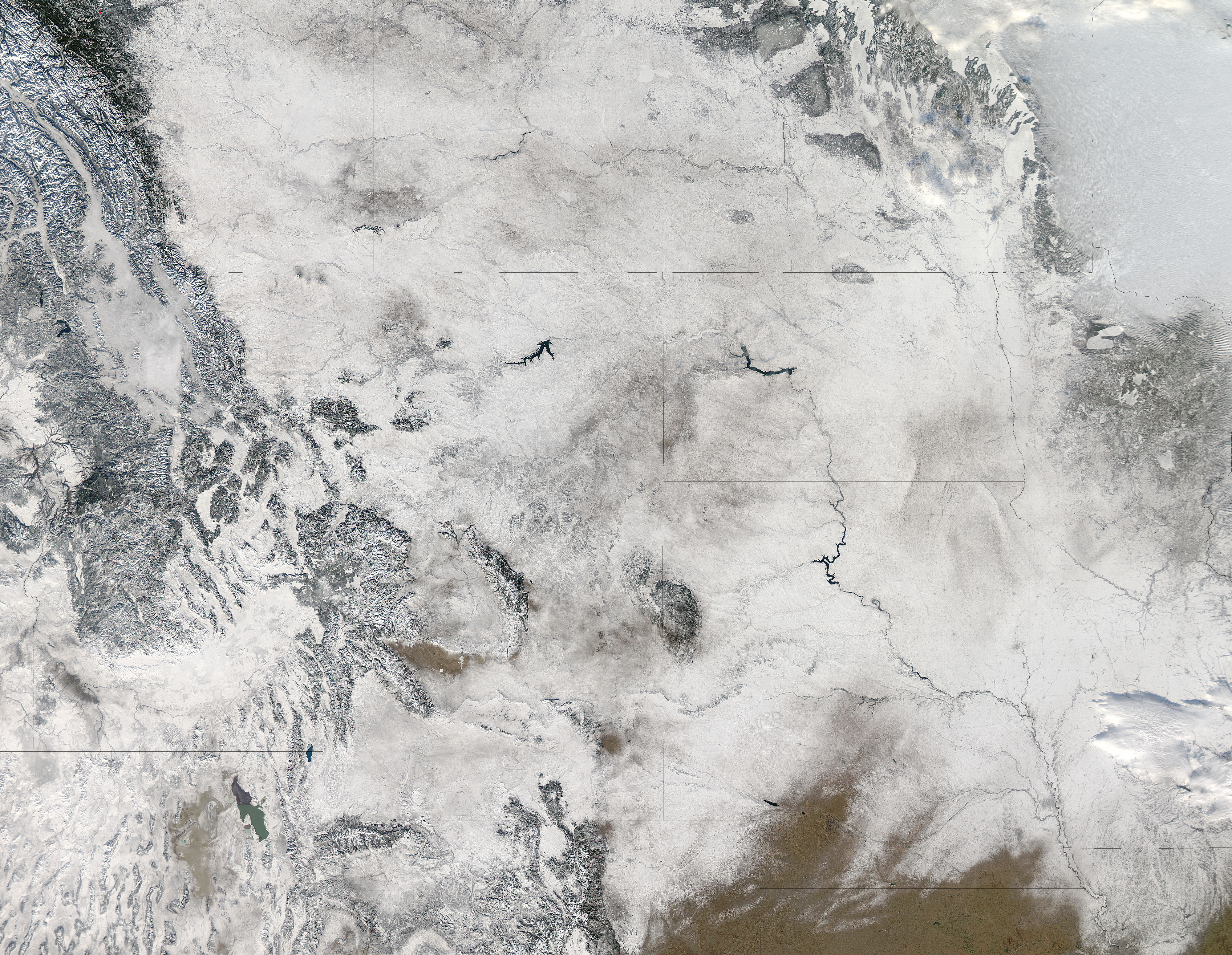
An unseasonably warm December across much of central North America ended with a bang: a major winter storm that buried the region under a blanket of snow. The storm system, named Goliath by The Weather Channel, swept across the United States and southern Canada bringing tornadoes and snow to Texas, flooding in the Midwest and fierce blizzard conditions from the Southern Plains to the Northeast from December 24 through December 30, 2015. It is being called the deadliest storm of 2015, with a total of 52 weather-related deaths reported, twenty-two from flooding conditions, eleven due to a severe tornado outbreak, and the remainder related to snow and blizzard conditions, including traffic accidents.
The Moderate Resolution Imaging Spectroradiometer (MODIS) aboard NASA's Aqua satellite captured this true-color image of the white aftermath of Goliath across central North America on January 1, 2016.
Snow stretches from the southern Canadian provinces of (from west to east) Alberta, Saskatchewan, Manitoba and Ontario. In the United States, parts of fourteen states are covered with snow: Washington, Oregon, Idaho, Montana, North Dakota, South Dakota, Minnesota, Iowa, Missouri, Nebraska, Colorado, Wyoming, Utah, and Nevada. Only in Kansas can an appreciable amount of winter-brown grassland be seen, with only small bands of snow lying near the borders of the state.
Image Facts
Satellite:
Aqua
Date Acquired: 1/1/2016
Resolutions:
1km (1 MB), 500m (3.9 MB), 250m (9.5 MB)
Bands Used: 1,4,3
Image Credit:
Jeff Schmaltz, MODIS Land Rapid Response Team, NASA GSFC
