
Images


May 1, 2017 - Fires in Yucatan
 Tweet
Tweet
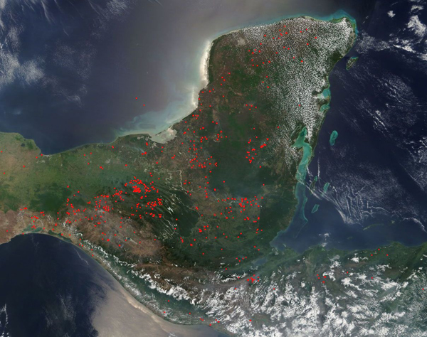
April is in the middle of the dry season for the Yucatan Peninsula and this year a drought has rendered some of the region’s most valuable biosphere preserves at high risk of wildfire. A high number of aggressive fires had ignited by April 19, 2017, that the Guatemalan government declared a 30-day, nationwide state of emergency to facilitate efforts to combat and control forest fires, according to a story published by Mongabay.
Most of the fires in Guatemala are burning in the Maya Biosphere Reserve, in the northernmost section of the country. The reserve is larger than Yellowstone National Park and was created in 1990 to try to preserve and protect a diverse and important ecosystem while allowing and balancing human activities. According to media reports, a number of large and damaging fires in the region are suspected to have been ignited by illegal clearing of land for cattle ranches and drug trafficking. Fires are not restricted to Guatemala, but many dozen also burn across Mexico while very few are present in Belize, on the southwest side of the Yucatan Peninsula.
On April 25, 2017, the Moderate Resolution Imaging Spectroradiometer (MODIS) aboard NASA’s Terra satellite captured a true-color image of fire activity across the Yucatan. Each red hot spot is an area where the thermal bands on the instrument detected temperatures higher than normal. When accompanied by smoke, as in this image, such hot spots mark actively burning fire.
Image Facts
Satellite:
Terra
Date Acquired: 4/25/2017
Resolutions:
1km (213.9 KB), 500m (2.7 MB), 250m (2.3 MB)
Bands Used: 1,4,3
Image Credit:
Jeff Schmaltz, MODIS Land Rapid Response Team, NASA GSFC
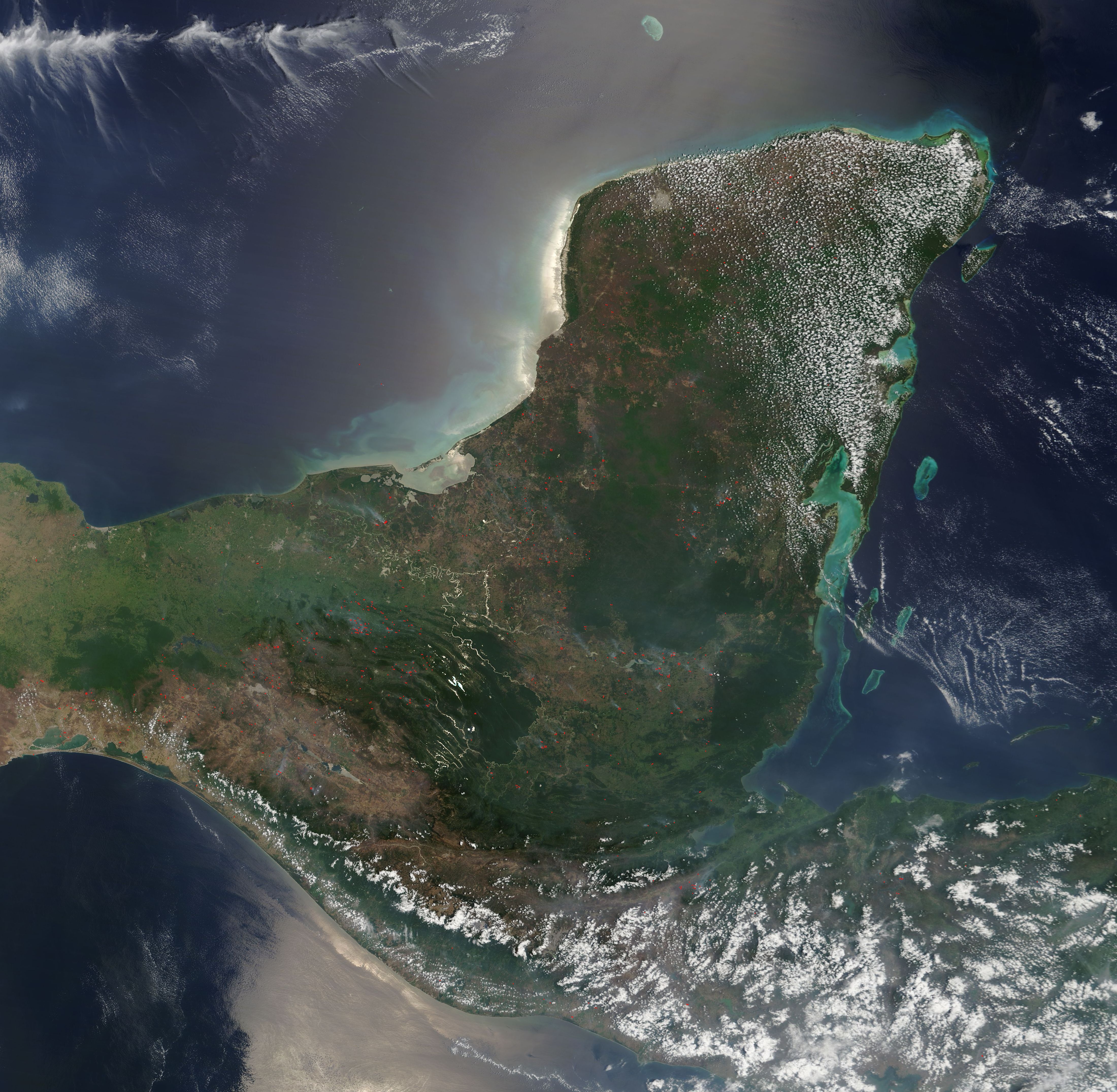
