
Images


May 18, 2025 - Popcorn Clouds Along the Congo River
 Tweet
Tweet
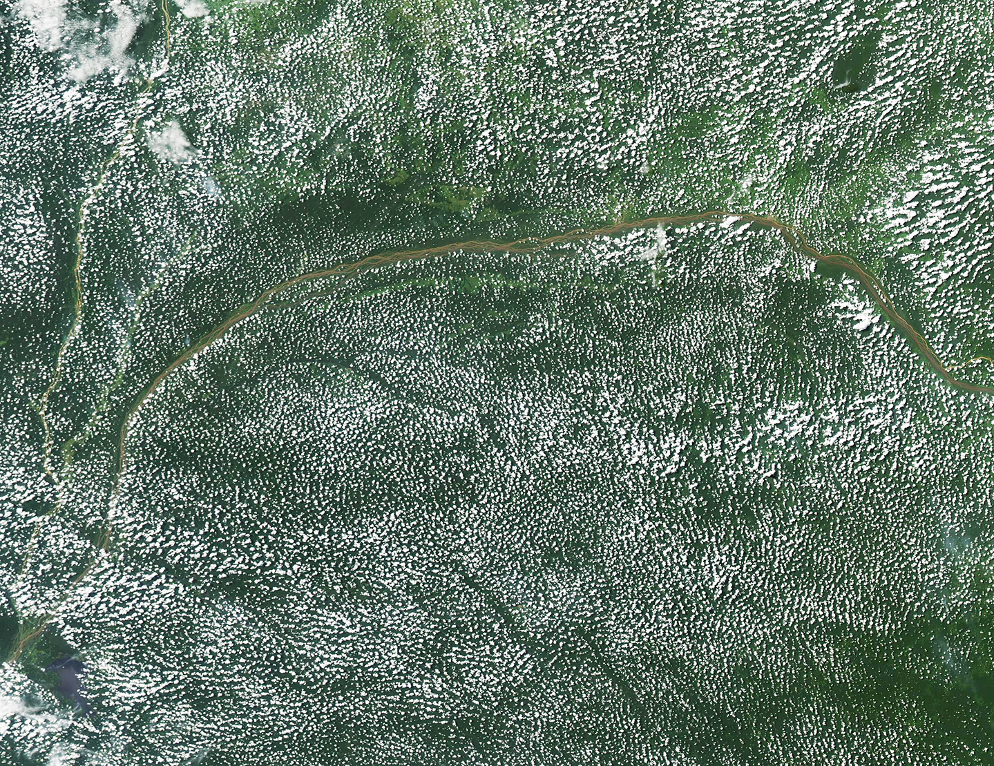
The Congo River Basin has been called one of the cloudiest places on Earth. This true-color image, acquired by the Moderate Resolution Imaging Spectroradiometer (MODIS) on NASA’s Aqua satellite on May 13, 2025, shows widespread “popcorn” clouds blanketing the rainforests along the Congo River.
The widespread clouds are actually a type of low-altitude cumulus cloud, but their unique round, puffy shape earned them the nickname of “popcorn cloud”. They form when warm, humid air rises from the grasses and forests, then cools as it rises, resulting in the development of the clouds.
While the rainforests are blanketed in these unique clouds, the air over the Congo River itself remains cloud-free. That’s because the air above rivers, oceans, or other large water bodies are cooler than the land, so less warm moisture rises in the atmosphere—and it’s that warmth and moisture that is required to form these clouds.
Image Facts
Satellite:
Aqua
Date Acquired: 5/13/2025
Resolutions:
1km (2.2 MB), 500m (2.2 MB), 250m (6.1 MB)
Bands Used: 1,4,3
Image Credit:
