
Images


May 22, 2017 - Dust storm in the Sahara Desert
 Tweet
Tweet
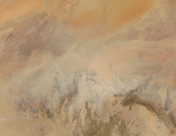
Strong winds swept over the Sahara Desert in mid-May 2017, driving massive amounts of sand and dust into the atmosphere. The Moderate Resolution Imaging Spectroradiometer aboard NASA’s Terra satellite captured this true-color image on May 16.
The image is centered on southern Algeria and the orange and tans of the Saharan landscape are nearly completely obscured from view by thick layers of dust and sand. Even the dark browns of the rugged Hoggar Mountains is obscured by a blanket of tan.
The Sahara Desert is a near-uninterrupted band of sand and scrubland that stretches across the northern third of Africa, and almost four-fifths of the country of Algeria belongs to the Sahara. Strong winds, which drive sand and dust storms, are common in the region, making such storms one of the primary natural hazards of Algeria.
Image Facts
Satellite:
Terra
Date Acquired: 5/16/2017
Resolutions:
1km (118.7 KB), 500m (405.3 KB), 250m (1.1 MB)
Bands Used: 1,4,3
Image Credit:
Jeff Schmaltz, MODIS Land Rapid Response Team, NASA GSFC
