
Images


June 18, 2017 - Tropical Storm Merbok (04W) over China
 Tweet
Tweet
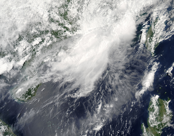
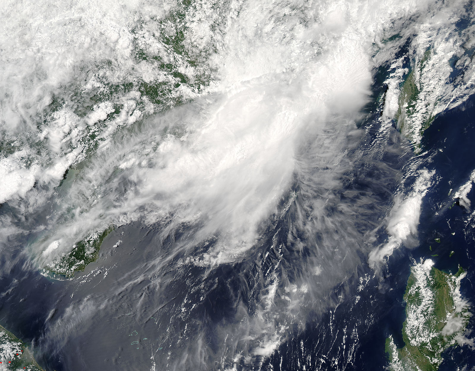
Tropical Storm Merbok formed in the South China Sea west of the Philippines on June 11 and made landfall east of Hong Kong, China on June 12.
The Joint Typhoon Warning Center (JTWC) reported that "animated radar imagery from Hong Kong indicated Merbok made landfall on June 12 between 1400 UTC (9 a.m. EDT) and 1500 UTC (11 a.m. EDT) shortly after the center passed 10 nautical miles east of Waglan Island, which reported maximum winds of 54 knots (62 mph/100 kph) with a minimum sea level pressure near 990.3 millibars."
JTWC issued their final warning on Merbok on June 12 at 2100 UTC (5 p.m. EDT). At that time, Merbok had maximum sustained winds near 40 knots (46 mph/74 kph) and was centered near 23.5 degrees north latitude and 114.9 degrees east longitude, about 47 nautical miles north-northeast of Hong Kong. Although Merbok was no longer a tropical cyclone on June 13, heavy rains continued to pound coastal China before it passed over the East Sea.
Although the storm was short-lived, the rains and wind proved costly. Approximately 12,000 people in Guandong province were evacuated, and over 30 homes were destroyed. The economic losses have been estimated to be around $38 million dollars.
The Moderate Resolution Imaging Spectroradiometer (MODIS) aboard NASA’s Terra satellite captured a true-color image of Tropical Storm Merbok over China on June 13. Although weakened, the elongated system still had dense clouds and was producing torrential rainfall.
Image Facts
Satellite:
Terra
Date Acquired: 6/13/2017
Resolutions:
1km (504.1 KB), 500m (1.6 MB), 250m (3.9 MB)
Bands Used: 1,4,3
Image Credit:
Jeff Schmaltz, MODIS Land Rapid Response Team, NASA GSFC
