
Images


July 22, 2017 - Hurricane Fernanda (06E) in the eastern Pacific
 Tweet
Tweet
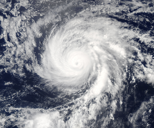
On July 17 at 6:10 p.m. EDT (2210 UTC) the Moderate Resolution Imaging Spectroradiometer (MODIS) aboard NASA's Aqua satellite provided a true-color image of Hurricane Fernanda. The image revealed strong thunderstorms continued to circle the low-level center of circulation, and the eye of the storm had become cloud-filled.
At 5 a.m. EDT (0900 UTC), the center of Hurricane Fernanda was located near 15.4 degrees north latitude and 132.8 degrees west longitude. That's about 1,495 miles (2,410 km) east of Hilo, Hawaii. Fernanda was moving toward the northwest near 9 mph (15 km/h). At 5:00 p.m. EDT (2100 UTC) Fernanda had weakened to a Category 2 storm on the Saffir-Simpson Hurricane Wind Scale, with maximum sustained winds of 110 mph (175 km/h).
By the afternoon of July 21 Fernanda moved into the Central Pacific Ocean as a weakening Tropical Storm. The National Hurricane Center (NHC) forecast that the system would likely dissipate by July 24 over open ocean.
Image Facts
Satellite:
Aqua
Date Acquired: 7/17/2017
Resolutions:
1km (989.9 KB), 500m (3.3 MB), 250m (8 MB)
Bands Used: 1,4,3
Image Credit:
Jeff Schmaltz, MODIS Land Rapid Response Team, NASA GSFC
