
Images


July 24, 2017 - Smoke and fires across western Canada
 Tweet
Tweet
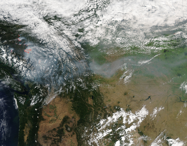
NASA's Aqua satellite spotted smoke from a large area of wildfires burning in southern British Columbia, Canada.
This true-color satellite image was acquired at 4:40 p.m. EDT (2040 UTC) on July 17, 2017 by the Moderate Resolution Imaging Spectroradiometer (MODIS) instrument that flies aboard Aqua. The thermal bands of the instrument detect heat signatures from fires, which are marked red on MODIS images. Red hot spots accompanied by typical smoke are diagnostic for actively burning fire.
A cluster of intensely burning fires can be seen burning between the Coast and Columbia Mountains in British Columbia. A large plume of smoke rises from the fires and blows more than 500 miles (800 km). The plume stretches across eastern British Columbia, Albert, and most of Saskatchewan, Canada. It also drifts south over Montana and Parks of North Dakota in the United States.
Image Facts
Satellite:
Aqua
Date Acquired: 7/17/2017
Resolutions:
1km (906.5 KB), 500m (3.1 MB), 250m (7.7 MB)
Bands Used: 1,4,3
Image Credit:
Jeff Schmaltz, MODIS Land Rapid Response Team, NASA GSFC
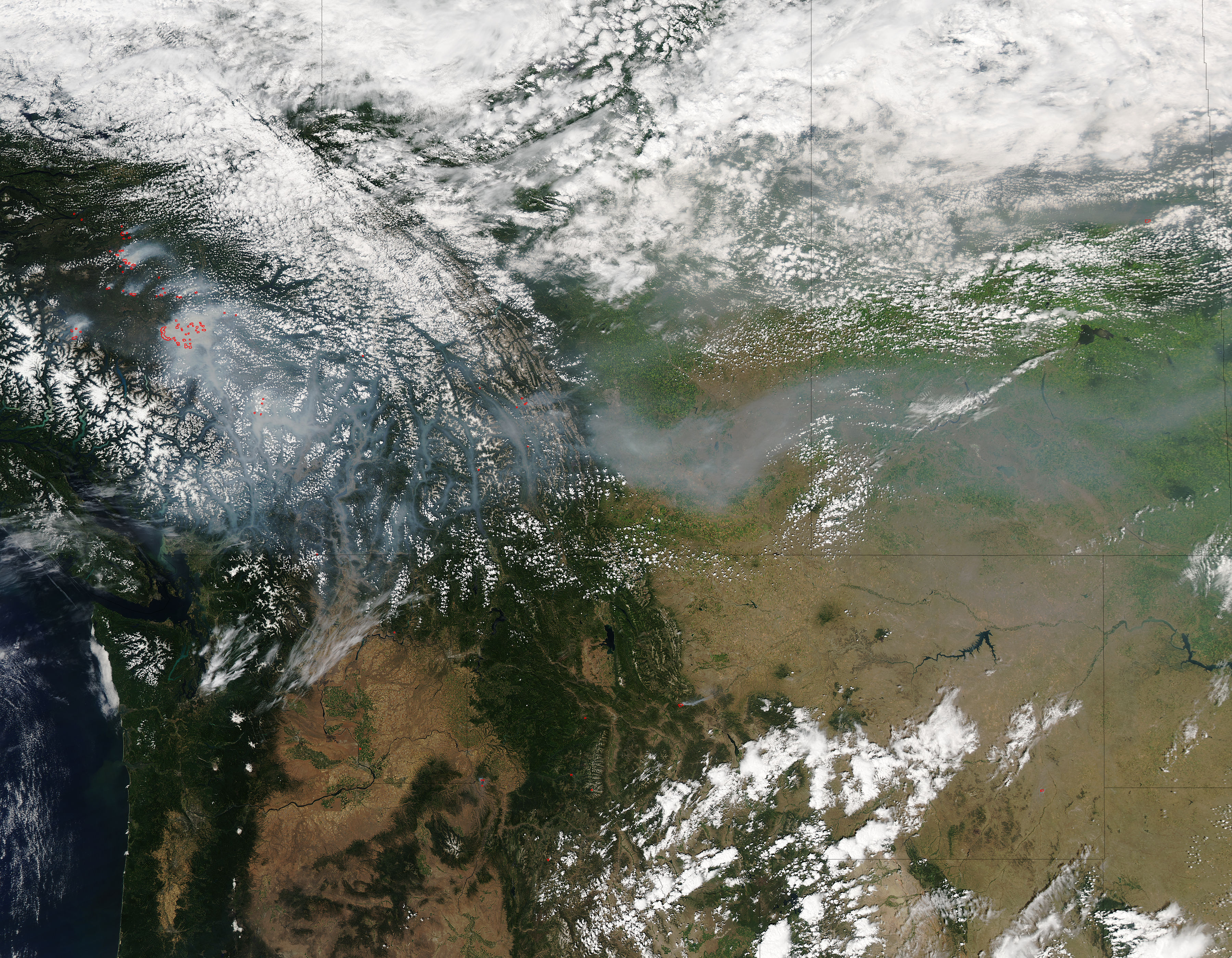
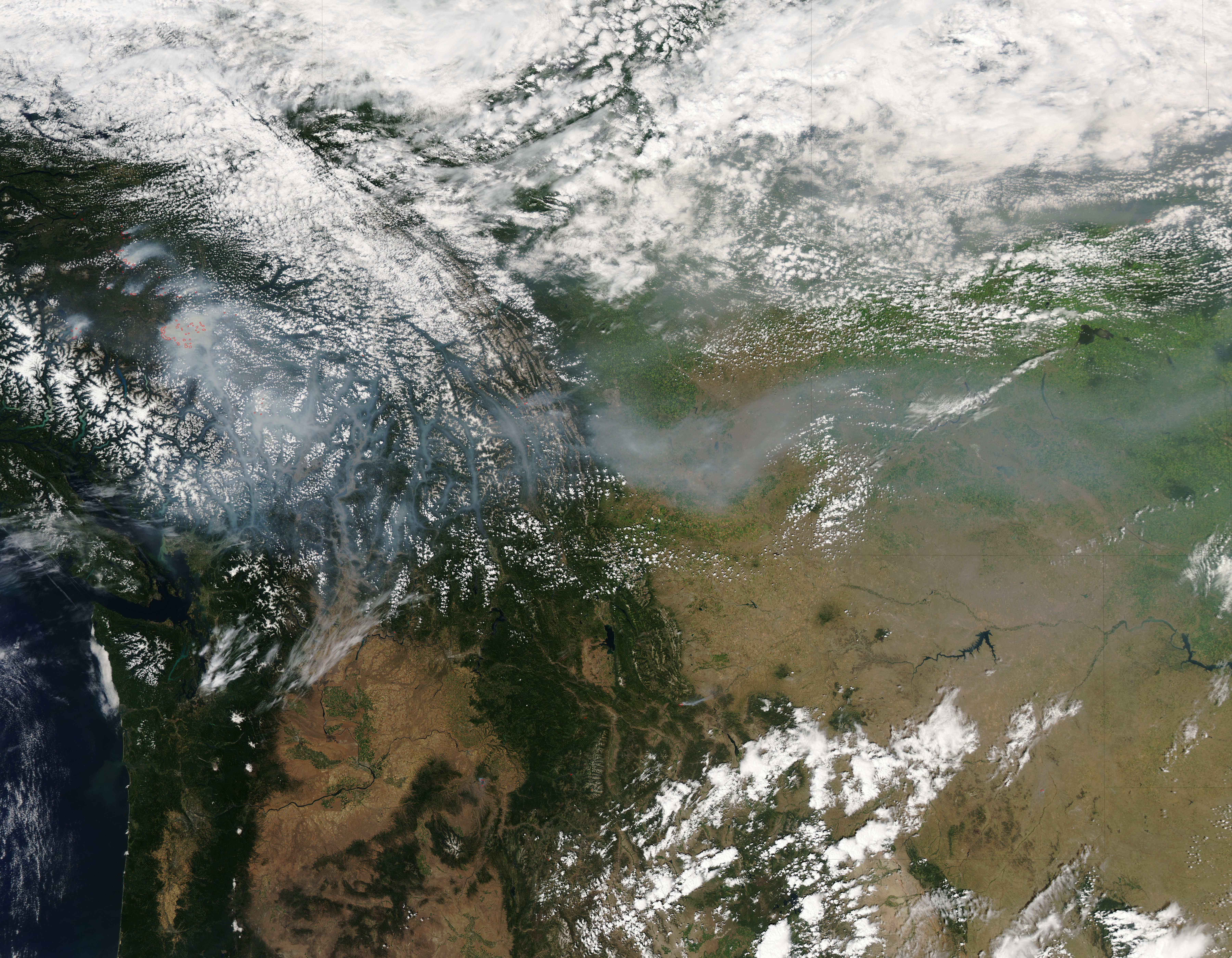
