Images
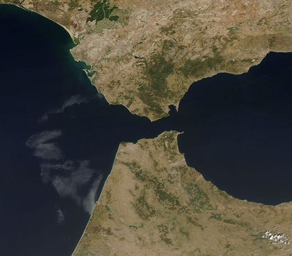
August 21, 2017 - Strait of Gibraltar
Tweet
The narrow Strait of Gibraltar separates the southern tip of the Iberian Peninsula from northwestern Africa. At the narrowest point, only 8.9 miles (14.2 km) of water lie between Spain and Morocco. It is also the area where the waters from the Mediterranean Sea mix with the Atlantic Ocean. The warm, relatively fresh water from the Atlantic Ocean flows eastward into the Mediterranean Sea as a top layer as, in turn, a colder, saltier layer flows westward from the Mediterranean into the Atlantic Ocean.
On August 4, 2017, the Moderate Resolution Imaging Spectroradiometer (MODIS) aboard NASA’s Aqua satellite acquired a true-color image centered on the Strait of Gibraltar.
Image Facts
Satellite:
Aqua
Date Acquired: 8/4/2017
Resolutions:
1km (56.9 KB), 500m (130.8 KB), 250m (158.7 KB)
Bands Used: 1,4,3
Image Credit:
Jeff Schmaltz, MODIS Land Rapid Response Team, NASA GSFC


