
Images


September 7, 2017 - Tropical Storm Lidia (14E) over western Mexico
 Tweet
Tweet
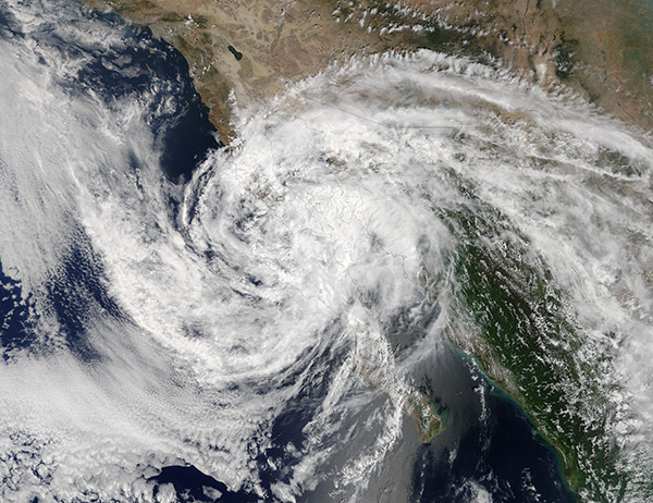
While Hurricane Harvey and Hurricane Irma were catching headlines, another killer storm was battering western Mexico. Tropical Storm Lidia dropped as much as 27 inches of rain over Baja California and the western Mexican coast. With peak maximum sustained winds of only 102 mph (193 km/h), the primary damage from Lidia came from torrential rains rather than the winds. Up to 27 inches (68.6 cm) of rain were reported over parts of Baja California and western Mexico. Seven deaths were attributed to Tropical Storm Lidia.
The National Hurricane Center (NHC) starting issuing advisories on Tropical Storm Lidia, the fourteenth tropical cyclone and twelfth named storm of the 2017 hurricane season as it spun up in the Pacific Ocean just of the coast of Mexico on August 29. The last advisory was issued on September 3, when the storm had weakened to a remnant low.
The Moderate Resolution Imaging Spectroradiometer (MODIS) aboard NASA’s Terra satellite acquired a true-color image of Tropical Cyclone Lidia over western Mexico on September 2. At the time this image was acquired, the storm was rapidly weakening into a post-tropical depression.
Image Facts
Satellite:
Terra
Date Acquired: 9/2/2017
Resolutions:
1km (795.2 KB), 500m (2.5 MB), 250m (6.1 MB)
Bands Used: 1,4,3
Image Credit:
Jeff Schmaltz, MODIS Land Rapid Response Team, NASA GSFC
