
Images


September 15, 2017 - Amazon River Delta
 Tweet
Tweet
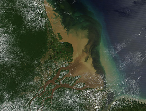
On August 6, 2017, the Moderate Resolution Imaging Spectroradiometer (MODIS) aboard NASA’s Terra satellite acquired a stunning true-color image of the Amazon River Delta.
The Amazon River rises in the icy glaciers covering the peaks of the Andes Mountains. Drops of water from the glaciers form multiple tiny rivulets, which converge into a series of small rivers. The rivers wind across more than 4,000 miles (about 6,500 km) across Peru, Bolivia, Venezuela, Columbia, Ecuador and Peru before reaching the broad Amazon River Delta. About 7.7 million cubic feet (219,000 cubic meters) pour into the Atlantic Ocean from the Amazon every second – roughly 88 Olympic-sized swimming pools. The Amazon carries about twenty percent of the entire global riverine flow into the oceans of the world.
As the Amazon River pours down the mountains, through rich forests, and across agricultural lands the waters picks up sediment and large amounts of organic matter. The large volume of water pouring from the Amazon River forms a large plume of nutrient rich, fresh water that extends well into the saline Atlantic Ocean. The plume has enormous impact on the near-shore ecosystem of the region, including feeding colonies of microscopic, surface dwelling ocean plants (phytoplankton) that, in turn, feed a diverse population of fish.
Image Facts
Satellite:
Terra
Date Acquired: 8/6/2017
Resolutions:
1km (216.9 KB), 500m (648.6 KB), 250m (1.2 MB)
Bands Used: 1,4,3
Image Credit:
Jeff Schmaltz, MODIS Land Rapid Response Team, NASA GSFC
