
Images


September 26, 2025 - Horn of Africa
 Tweet
Tweet
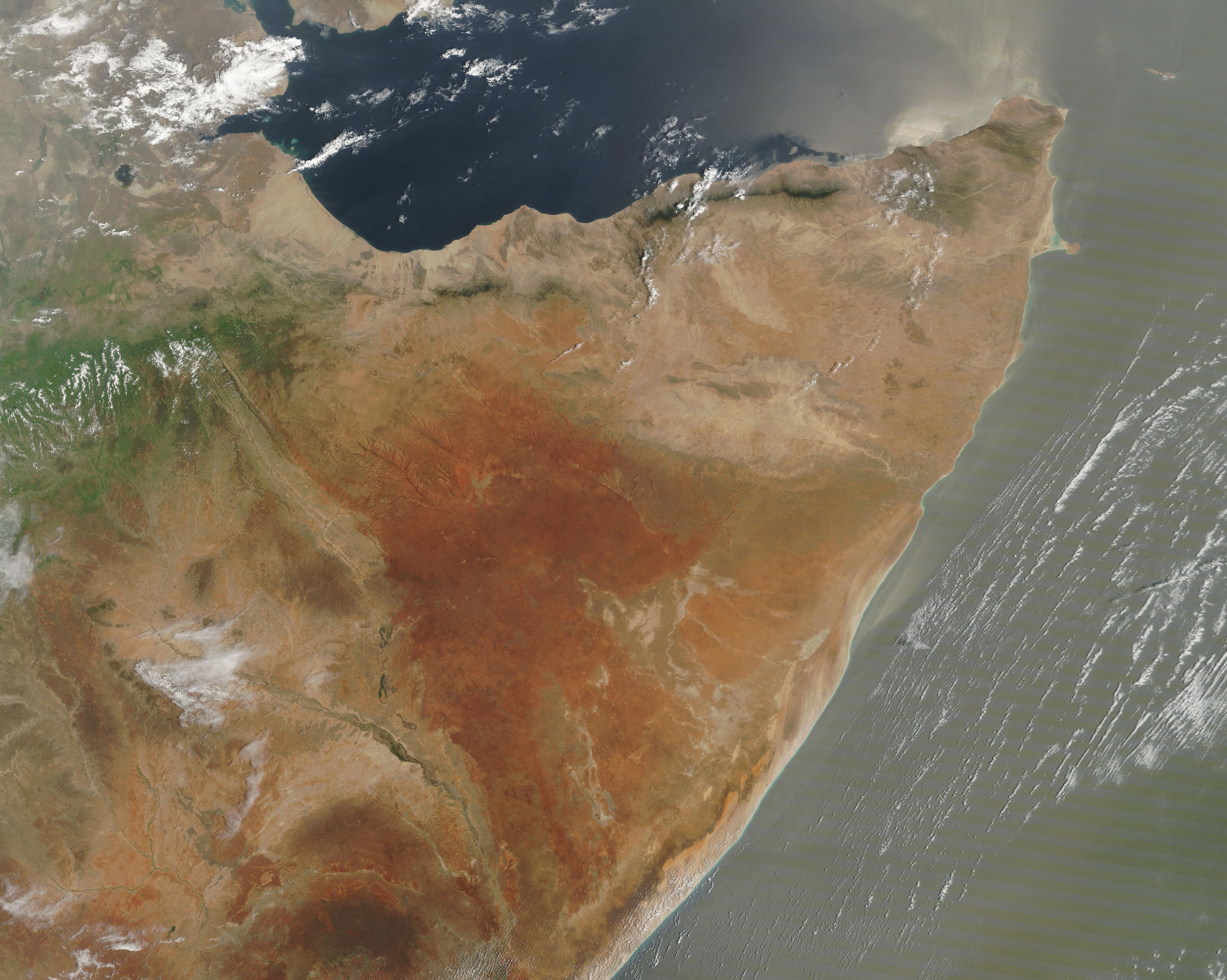
On September 25, 2025, the Moderate Resolution Imaging Spectroradiometer (MODIS) on NASA’s Terra satellite acquired this true-color image of the Horn of Africa.
The fourth-largest peninsula on Earth, the Horn of Africa spans about 726,975 square miles (1.8 million square kilometers) of highlands, desert, and coastal mountains in far eastern Africa. The Horn is bounded by the Red Sea, Gulf of Aden, and Indian Ocean and is home to several countries. From northwest moving clockwise, the coastal countries include Eritrea, Djibouti, and Somalia, and all of these countries surround the inland country of Ethiopia.
Most of the Horn of Africa encompasses arid, hot desert that supports little agriculture. The exceptions include areas that are tinted green with vegetation in this image, although not all of the vegetated regions can be successfully farmed. The Harrar Massif, which is the green-toned mountain range in the west, is a rugged country made up of high plateau and steep mountains, two of which rise to over 4,000 feet. The Ogo Mountains are a thin strip of forested peaks parallel to the coast of the Gulf of Aden. In the south, green marks the path of the Shabelle River, which is the center of agriculture in Somalia. In the rest of the country, nomadic herding is more common.
Image Facts
Satellite:
Terra
Date Acquired: 9/25/2025
Resolutions:
1km (303.2 KB), 500m (933.8 KB), 250m (2.1 MB)
Bands Used: 1,4,3
Image Credit:
MODIS Land Rapid Response Team, NASA GSFC
On September 25, 2025, the Moderate Resolution Imaging Spectroradiometer (MODIS) on NASA’s Terra satellite acquired this true-color image of the Horn of Africa. The fourth-largest peninsula on Earth, the Horn of Africa spans about 726,975 square miles (1.8 million square kilometers) of highlands, desert, and coastal mountains in far eastern Africa. The Horn is bounded by the Red Sea, Gulf of Aden, and Indian Ocean and is home to several countries. From northwest moving clockwise, the coastal countries include Eritrea, Djibouti, and Somalia, and all of these countries surround the inland country of Ethiopia.
Most of the Horn of Africa encompasses arid, hot desert that supports little agriculture. The exceptions include areas that are tinted green with vegetation in this image, although not all of the vegetated regions can be successfully farmed. The Harrar Massif, which is the green-toned mountain range in the west, is a rugged country made up of high plateau and steep mountains, two of which rise to over 4,000 feet. The Ogo Mountains are a thin strip of forested peaks parallel to the coast of the Gulf of Aden. In the south, green marks the path of the Shabelle River, which is the center of agriculture in Somalia. In the rest of the country, nomadic herding is more common.
Image Facts
Satellite:
Terra
Date Acquired: 9/25/2025
Resolutions:
1km (303.2 KB), 500m (933.8 KB), 250m (2.1 MB)
Bands Used: 1,4,3
Image Credit:
MODIS Land Rapid Response Team, NASA GSFC
