
Images


December 20, 2017 - Yucatan Peninsula
 Tweet
Tweet
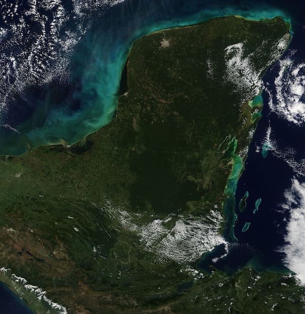
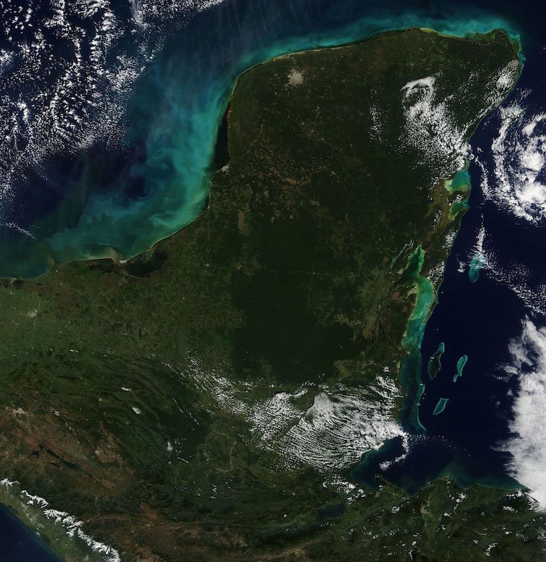
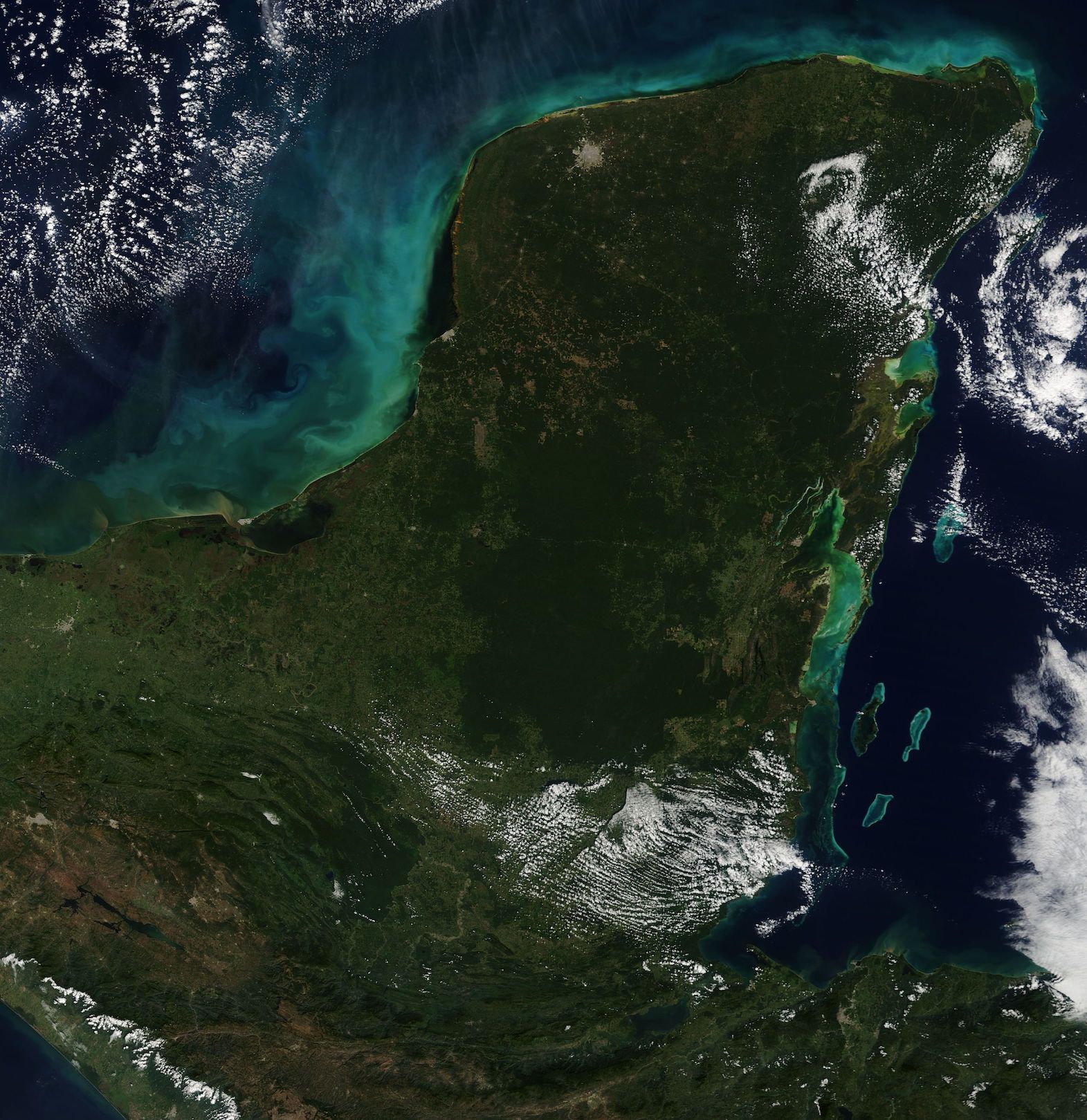
According to travel websites, Mexico’s Yucatan Peninsula has what it takes to attract a crowd – gorgeous beaches, upscale resorts, jungles, and ancient ruins. The large peninsula spans about 76,300 square miles (197,000 square km), and includes the states of Yucatan, Quintana Roo and Campeche as well as, in the south, parts of Belize and Guatemala. With a coastline of about 200 miles (320 km), beaches are certainly plentiful.
The Mayan civilization – the most famous on the Yucatan Peninsula – dates to about 2000 B.C. and reached its peak from 300-900 A.D., or the “Classic Era” of Mayan culture. It was during this time that the stylized stone statues of important kings or rulers began to appear. Known as stelae, these stones also included a record of the ruler’s accomplishments. The Classic Era was also a time of construction of temples, pyramids and palaces, many of which still stand as ruins. The Mayan culture, although in descendancy, remains alive, with remnant populations still practicing traditional religion and following Mayan customs.
The Yucatan Peninsula is rich in rainforest and jungle, especially inland and southward. As one travels northward the jungles slowly give way to different vegetation – first to semi-deciduous low-to-medium height forests then, near the northwestern shores, to dry, deciduous scrub (sometimes called thornforest). Mangroves flourish in brackish areas along the coast. The unique vegetation of the northwest combined with the relative isolation from other land results in ecological isolation, with the result that this region is home to many animal and plant species are found nowhere else on Earth.
The Moderate Resolution Imaging Spectroradiometer (MODIS) aboard NASA’s Terra satellite acquired a true-color image of the Yucatan Peninsula on December 18, 2017. The large gray circular area marks the city of Merida – the capital of the Yucatan state and the largest city on the Yucatan Peninsula.
Image Facts
Satellite:
Terra
Date Acquired: 12/18/2017
Resolutions:
1km (138.2 KB), 500m (490.3 KB), 250m (1.4 MB)
Bands Used: 1,4,3
Image Credit:
Jeff Schmaltz, MODIS Land Rapid Response Team, NASA GSFC
