
Images


February 28, 2018 - Japan
 Tweet
Tweet
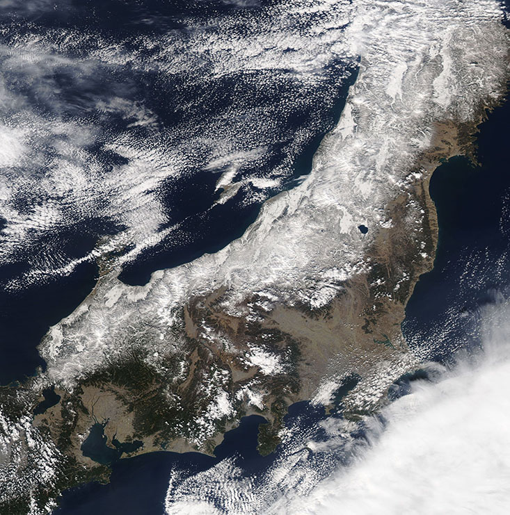
Northwestern Honshu Island, Japan was covered in heavy snow when NASA’s Aqua satellite passed overhead on February 26, 2018. The Moderate Resolution Imaging Spectroradiometer (MODIS) acquired a true-color image of the wintery scene on that same day.
Honshu is Japan’s largest island and is sometimes considered the mainland of Japan. The coastline of the Pacific Ocean (east) hosts a number of bays with ideal safe harbors for commerce, and it has become Japan’s primary economic center. The island’s small percentage of arable land is also found primarily on the coastal plains on the eastern side.
Most of Honshu’s landscape is ruggedly mountainous. Mt. Fuji, Japan’s highest mountain, sits near the Pacific Coastline at the head of Suruga Bay. Suruga Bay is the large inlet near the center of the image. Mt. Fuji, also known as Fuji-san or Fujiyama, rises to 12,388 feet (3,776 meters) about 60 miles (100 km) west of the metropolitan area of Tokyo-Yokohama. Both the summit Mt. Fuji and Tokyo-Yokohama are covered by swatches of white cloud in this image.
Image Facts
Satellite:
Aqua
Date Acquired: 2/26/2018
Resolutions:
1km (252.3 KB), 500m (704.3 KB), 250m (1.6 MB)
Bands Used: 1,4,3
Image Credit:
Jeff Schmaltz, MODIS Land Rapid Response Team, NASA GSFC
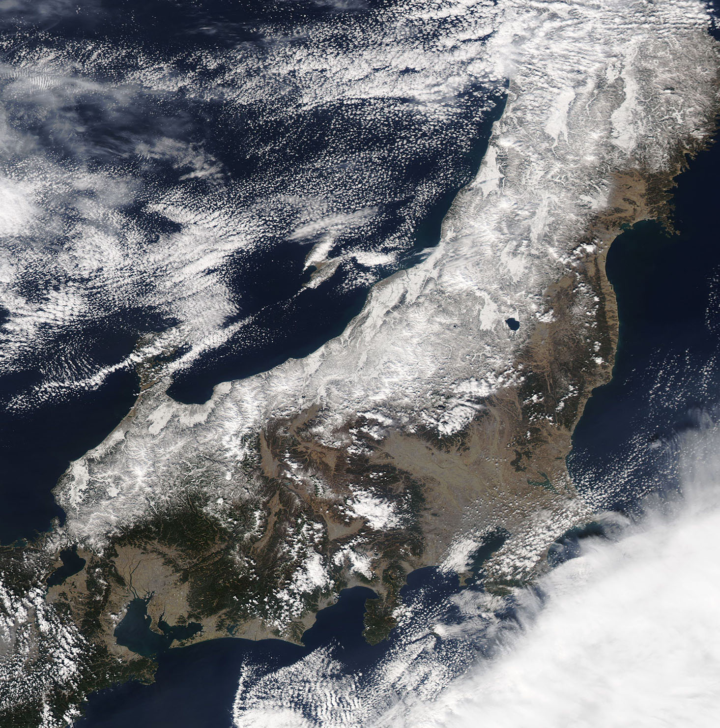
