
Images


December 24, 2018 - Middle East
 Tweet
Tweet
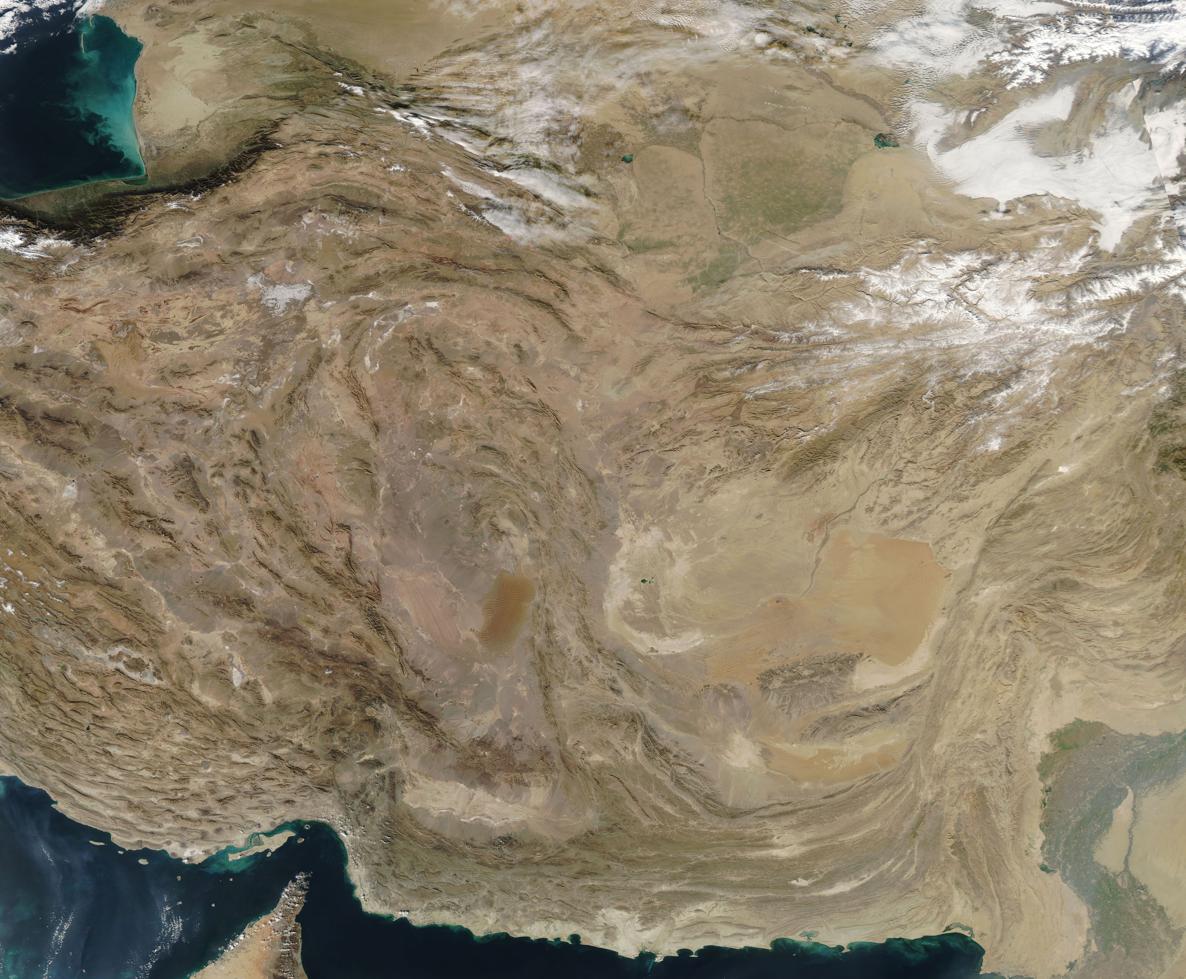
On December 16, 2018, NASA’s Aqua satellite passed over the Middle East, allowing the Moderate Resolution Imaging Spectroradiometer (MODIS) on board to acquire a beautiful true-color image of Iran, Afghanistan and Pakistan.
One notable feature readily identifiable in the west (left) of the image is the upfolding topography of the Zagros Mountains. Beginning north of the Persian Gulf near the narrow Strait of Hormuz, the long mountain range extends about 990 miles (1,600 km), forming the extreme western boundary of the Iranian plateau. The area is actively undergoing crustal shortening as global tectonics move Arabia towards Asia. As a result, the layers of sedimentary rock are slowly folding upward in ridges, somewhat like a carpet folds upward if pushed. In this case, the compressive forces create massive folds – the local relief between the higher mountain ridges and the valleys can be as much as 1200 meters (4,000 feet).
To the east, in southern Afghanistan, an apparently smooth area of orange-tinted tans marks the large Registan Desert. The desert terrain is, indeed, relatively flat, but fails to meet the criteria of “smooth”, at least at ground level. The winds, which blow consistently form the same direction, causes sand to pile up in crescent-moon shaped dunes, whose thin tips point in the direction of the wind flow. Called barchan dunes, these dunes will migrate across the desert surface as sand grains on the crest of the dune are toppled by the wind and spill down the leeward face. As the pile of sand on the leeward side of the dune gets larger, gravity eventually topples the pile, moving the dune’s leading edge slowly forward. The movement is slow but steady – some barchan dunes can migrate between 8 and 15 feet each year.
Image Facts
Satellite:
Aqua
Date Acquired: 12/16/2018
Resolutions:
1km (2.7 MB), 500m (7.8 MB), 250m (6.3 MB)
Bands Used: 1,4,3
Image Credit:
MODIS Land Rapid Response Team, NASA GSFC
