Images
March 31, 2019 - Floods in Iran
Tweet
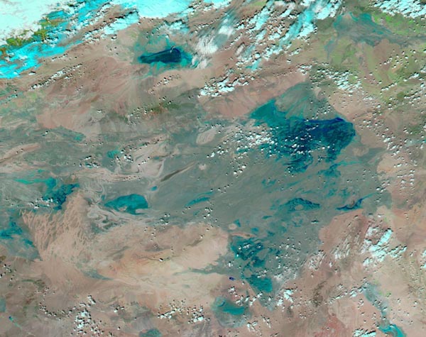
Heavy rainfalls have drenched northern and southern Iran, much of Iraq, and eastern Turkey since mid-March, 2019. According to Reliefweb, parts of Iran received more 200 mm (7.9 in) in the last 10 days. The heavy rain triggered devastating and deadly flash flooding, with 56,000 people affected in Glestand and Mazandarante Province and hundreds of buildings damaged in Fars Province, especially in Shiraz city. As of March 29, more 45 people were reported killed with about 100 additional injured. Rural areas of Wasit, Babil, Basra, and Ninevah provinces in Iraq were also suffering from flooding.
On March 27, 2019, the Moderate Resolution Imaging Spectroradiometer (MODIS) on board NASA’s Aqua satellite acquired a false-color image of flooding in northwestern Iran near the border with Iraq. In this combination of visible light and infrared, clouds appear white or electric blue, water appears green and land appears brown. While the single image clearly shows extensive flooding in Iraq (west and south) and Iran, the extent of the flooding is best appreciated with a comparison with imagery from before the flooding. A roll-over comparison of this area can be seen HERE
Image Facts
Satellite:
Aqua
Date Acquired: 3/27/2019
Resolutions:
1km (70.4 KB), 500m (185.8 KB), 250m (425.9 KB)
Bands Used: 7,2,1
Image Credit:
MODIS Land Rapid Response Team, NASA GSFC


