
Images


September 5, 2019 - Bohai Sea
 Tweet
Tweet
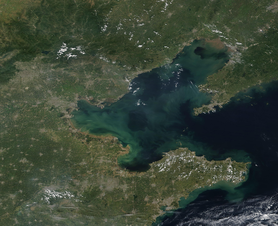
On August 31, 2019 the Moderate Resolution Imaging Spectroradiometer (MODIS) on board NASA’s Terra satellite acquired a true-color image of the Bohai Sea. Swirls of tan and greens color the blue waters, created by sediment and phytoplankton moving in the currents. Smudges of gray and tan pixels on land mark man-made structures, including many cities. Near the far left edge of the image, the large area of gray represents the city of Beijing.
Edged by one of the most-developed regions of China, Bohai Bay faces a myriad of demands. The waters support a large spawning and feeding ground for several species of fish, which is important to sustain species populations as well as to the fishing industry. The Bohai Sea, alone, accounts for between 28% to 40% of the total catch in both the Bohai and Yellow Sea annually. Meanwhile, gas and oil fields under the Sea are a rich source of income for many. In February 2019, a large discovery of oil and gas reserves was announced – the largest such discovery in 50 years. China Daily reported that the reserve could be used by millions of city dwellers for hundreds of years. Bohai Sea also provides recreation and transportation for tourists, residents, and commercial entities.
The pressure on the Sea’s resources, both directly and from the large population and industries along the shoreline, has had an impact on the waters. A study by Ming Xin et. al. was published in September 2019 in the Marine Pollution Bulletin and looks at changes in water parameters over the last 60 years. The findings show that dissolved inorganic nitrogen has increased 7-fold over that time, while phytoplankton biomass has increased by 6-fold. The authors also noted a change in the species of the plant-like microorganisms (phytoplankton) over time. Red tides rarely occurred before the 1980s but have occurred frequently since the 1990s.
Image Facts
Satellite:
Terra
Date Acquired: 8/31/2019
Resolutions:
1km (529.1 KB), 500m (1.4 MB), 250m (1.1 MB)
Bands Used: 1,4,3
Image Credit:
MODIS Land Rapid Response Team, NASA GSFC
